A Map of the Body, a Map of the Mind. Visualising Geographical Knowledge in the Roman World

Author Iain Ferris offers an introduction to his forthcoming book in the Archaeopress Roman Archaeology series.

I remember being flooded with a grief so old
I remember the butcher’s shop on the Viminal Hill

My latest book is about the relationship between geography and power in the ancient Roman world, and most particularly about the visualisation of ideas about geography in the form of ‘geography products’*, at the interface between art and the geo-political environment.

Figure 1. Example of a Roman ‘geography product’. Statue personification of the River Arno. Exact provenance uncertain, probably Rome. Hadrianic. Musei Vaticani, Rome. (Photo: Author).

As Rome broke its political bounds and headed towards empire the whole city became the centre of a larger world and the Roman worldview changed with it. The Roman state then needed to present to the Roman people an easily digestible narrative about its imperial ambitions and its imperial possessions, in a way that went beyond the fact that servitude, enslavement, and misery for many underpinned this expansion. There needed to be a publicly guided discourse centred around the smoothing out of difference, rather than its obliteration or elimination, and the presentation of very different lifeworlds in a familiar way. It marked a way of directing how change could be managed and a way of reimagining how the world might be and might work at the intersection between selection, presentation, knowledge, and insight. Reflection and communication sought then to create a communal sense of belonging.

By intensifying practices that stressed Roman individuality a process of drift was mitigated. Rome after all was not the first power to establish wide Mediterranean networks beyond home territory: indeed far from it. Rome’s external relationships were underpinned by strongly-articulated localised expressions which served to demarcate identity both internally and externally. Local and global practices interacting together played a significant and important role in Rome becoming what might awkwardly be called Mediterraneanised, as had previously and variously happened for others.

The creation of the Roman empire and its expansion almost inevitably led to a recalibration of spatial relationships between Rome and Italy and between Roman Italy and the rest of the known world as it was then. It is true to say that the detail is often in the small print of Roman culture, in its undercurrents. Geographical thinking shaped the forms of contemporary art then, even if only at the level of sub-genres, thus making my study a geography of art but not a study of geography in art, a political geography of the Roman world told through images, a strange spatial ontology layered onto Rome’s fixity in defined physical space. Extraterritoriality such as this can signify openness, freedom, imprisonment, or subjugation. 

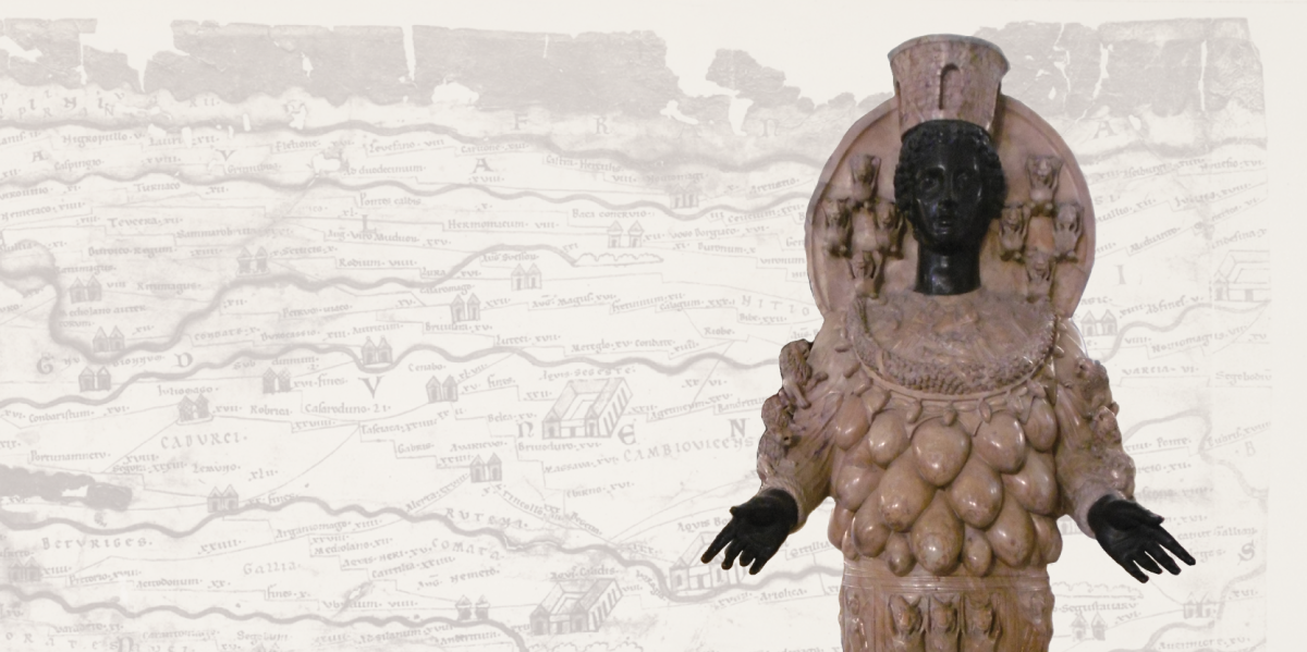
When writing the book there was an immediate realisation that the use of the umbrella categorisation of disparate ‘things’ as ‘geography products’ offered a number of potentially critical openings for looking at ancient Rome and its defining of place and space: that a new strand of critical conversation and dialogue could be started. Broadly such products included a slew of visual sources which acted as mnemonic triggers to spatial awareness and the definition can even be extended to encompass tastes, sounds, and smells which might have had the same effect. Written histories, geographic texts, ethnographic studies, poems, epigrams, plays, maps, drawn surveys, and inscriptions could also be geography products. Personifications, bodies and images of bodies could also on occasions be geography products or carry on them such information as to qualify in this respect: land, space, and place literally could be written on the body. I certainly believe that adopting this strategy of definition has allowed narratives, plots, structures, and themes in the evidence to emerge.

Figure 2. Example of a Roman ‘geography product’. Sarcophagus depicting the Indian triumph of Bacchus, Ostia/Portus. Second to third century AD. Museo Archeologico Ostiense. (Photo: Author).

The history of Roman imperialism to some extent could be described as being a history of fragmentation and a history of exclusion. The city of Rome became a space where an attempt was made to create and present a kind of collective memory. If we can also then talk about moves towards inclusion our discussion has to be tempered with awareness of the constant undertow of cultural dislocation and alienation there. If environments can be said to inhabit us, then Rome became alive with peoples and products of the whole known world: it was not where you were but where you could be, through movement, transformation, becoming. The synaesthetic power involved must have been considerable, with light, music, texts, images, and architecture probably headily combining and proposing many routes through interzones into clear space, as images moved through time and mapped a geography of revelation and resolution. Low-frequency sightings rumbled up like suppressed memories of hauntological places, creating a topography of the human experience mediated by the viewer’s experiences and perspective.  This was as much an exploration of ideas about place, a discourse on desires and the city form, as it was a continuation of architectural traditions. 

Ideas relating to identity, alienation, assimilation, diaspora, and exile could be manifested and presented in the form of images in the Roman world without overt references to geography and origins, and yet inform viewers of just those very things through a mixture of lyricism and dialectics. These images were not simply part of a reflection of a separate or separated world of art: rather they were part of the passionate, rational, and dramatic aspects of everyday life at the time, sparking imaginations that were to be turned on the transformation of reality itself. Viewers were encouraged to discover within themselves desires for other, particular environments and places in order to make them seem real, to regenerate the nature of imagined experience under other skies. The tensions implicit in such strategies are obvious: the city became the total work of art, playing with the presentation of time, space, and place each in turn, then in tandem and combination. The solicitation of the city’s architecture and monuments was seductive and informative to those who were susceptible or open to suggestion. Information gleaned in this way reflected the absence of more practical means to orientate oneself in a changing and expanding world. The study and correlation of accepted snippets of geographical information obtained by cultural osmosis or sought out in a targetted manner on the city’s streets created new and what must sometimes have been very individual and idiosyncratic mental and emotional maps of both the existing cityscape and of distant imagined cities and places. These geographies framed Roman cultural practice. Representational and sometimes direct and sometimes almost abstract, intimate and monumental, systematised and impulsive, together these works did not break the rules of contemporary Roman art but they pushed the boundaries by signing up to all of them. If asked to say what they were about, I would say ‘everything’.

Although occasionally imprecise, these images conveying geographical information often in the form of architectural expression were often highly charged with emotionally evocative power and representing desires, control, events from the past, the present, and the future, rational extensions of religious experiences and myths. Imperial Rome ushered in a period of city planning seen as a means of knowledge exchange. Parts of the city could have corresponded to the feelings usually experienced by chance, but here managed or even manipulated. One could leave the realm of direct experience for that of representation and presentation. The passivity of the old, pre-imperial Rome needed to be reconstituted in some respects by a collective project explicitly concerned with confronting every aspect of the audience’s lived experiences, by drawing attention to the contrast between what contemporary life was actually like and what it could be. Rome could only find its poetry in the present, if informed by the past.

Figure 3. Roma/Tellus, the Ara Pacis Augustae, Rome. 13-9 BC. (Photo: Author).

Roman ideas and concepts about geographic space, about topography, about landscape, about foreign peoples, and about barbarians were developed, one might even say workshopped, in the theatrical sense, through a process of almost trial and error in terms of creating and presenting a coherent series of geography products which utilised words and images to telescope distance and space and to create maps of the body and maps of the mind. The recurrence of these intercalations between political ideology and images was not always simply a repetition of the same thing. There were undoubtedly significant shifts and developments in the way that these encounters were negotiated and whether a meaningful historical trajectory can be discerned in the multiplicity of meanings presented and entangled in the process.

Especially dramatic and portentous was how empowerment with geographic knowledge, when it took place, found expression in new aesthetic practices. Cultural power here was in many ways analogous to economic power. This was not to deny the inherent tension here, that the full pursuit of economic capital was usually incompatible with the full pursuit of cultural capital. Indeed, the process became altogether saturated with aesthetic discourses at the expense of other interpretations. A genealogy of such geographical images was not seeking to provide a continuous history, a seamless narrative, but rather to focus on certain eruptions, breaks, and displacements of the cultural field. It stressed heterogeneities and specificities. Genealogies focused on struggle and competition and were interested less in the narrative of events than in patterns and structures.

Everything in the geographical field must have acted like a citation, embedded discourse, mention rather than use. The false symmetries of good sense reflected techniques of compression and collage, myths of abjection and omnipotence. Homesickness was presented here as a pathology and became a conduit through which a world could emerge. Any attempt to constitute the images as settled carriers of meaning might have run aground on their incompleteness and inconsistency.

In the end almost everything that had directly lived under the Roman system moved into a representation, caught between everywhere and nowhere, geographical images embodying a very particular sensibility and representing a site or locus of deluded aspirations, and yet at the same time probably occasionally freeing the imagination and shackled ambition. All of this emerged in tandem with the defining motifs: consumption, art, the scrambling of linearity, the debasing of perceived truths or grand narratives, the collapse of representation into reality: tensions born of such developments were engaged with and played out in various ways. The ideology lay in its practice, in its ability to pleasure, surprise, transgress, inspire, question and imagine, a mode of critique rather than a definite answer or solution. It confronted, challenged, and gave vent to a message that was both resonant and ambiguous, and it provided a space or spaces to reflect upon or explore the social tensions contained within it. It helped collapse the distinction between here and there and in many ways sought instinct, passion, caprice, and violence. Such images demonstrated a conflict between feelings of being rooted and rootless, belonging and not belonging, place and displacement.

Compassionate scrutiny probably would have revealed the moral complexity of many geographical images, a desire to be fully part of the world mediated by images of oscillation and unsettledness and shadows. Revelation would have helped shatter the sense of continual change, initiating the reuse of images to allow the past to exist in the perennial present. No longer were lost or marginal cultural resources recovered and reimagined: they existed concurrently to be collated, imitated, decontextualised, and disarmed. The differences that had always been contested merged or conflated, and point and purpose hardened as cultural forms evolved away from their initial stimulus. Cultural changes enabled competing sites of attention to operate contemporaneously and probably sometimes competitively too, continuing to provide a means of agency and a platform, even as its cultural traces were archived, appropriated, and often historicised, as was so much of Rome’s cultural output.

A process of critical engagement must have been required on the viewer’s part though, as these images must sometimes have appeared to be contradictory and formative, implicit and explicit, liberatory and reactionary. Meanings were projected but also cultivated from within, shaping the dialogues that ensued as cultural spaces were opened up. The exploration of sexual, psychological, and delinquent extremes was surely a bi-product of the viewing of such images by certain viewers.

Taken together, the collective assemblage of Roman geography products and geographical images were like a series of return journeys which could not be judged on output alone. There was so much more hidden, suggested, left to the imagination. The mystery was left caged. It remained an exception to the rule. Moments of viewing must have helped provide insight into life as a series of potentially random journeys that one might take or might imagine oneself taking, showing some viewers some of the possibilities.

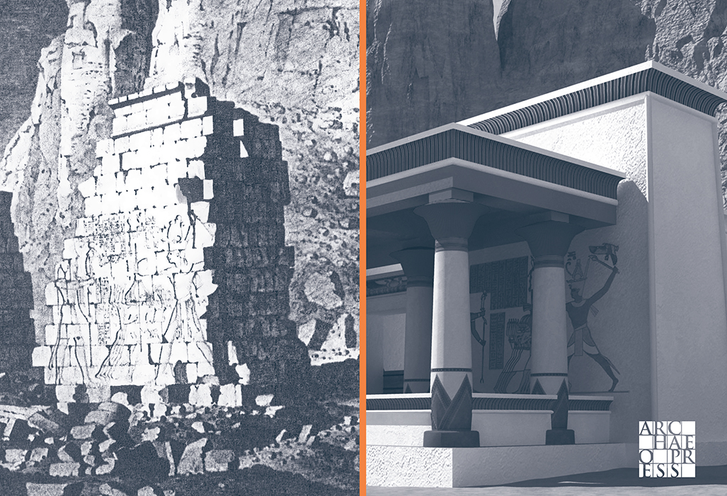
The Romans had many ways to manage geographical information, not only by preparing texts of one sort or another and by literally inscribing themselves on the land of others, and had many scientific ways of handling geographical data. The surveyors’ groma, the cadastral plot, the drawn or inscribed ground-plan of a building, the city plan, the travel itinerary. These were things to help order, understand, and control space and place. But in order to conceptualise geographical knowledge and information art needed to be employed to spark the imagination, to suggest connections, to scare, to bewilder, or even to reassure.

Figure 4. Wall of the Templum Pacis/Temple of Peace, Rome on which the Forma Urbis Romae (Severan Marble Map of the City of Rome) was mounted. Now part of the Church of SS. Cosma e Damiano. (Photo: Author).

These images had purpose, the images were maps of a kind. The great power of illusion, the often unspoken dynamics of society or community, and the excitement and thrill of pursuing empire and expansion all helped shape the people of Rome. The actual and emotional geography of the place in which they lived were intertwined, presented in a way that focused not so much on specific events but rather on subtexts, atmospheres, and perceptions. Though argued in the book not to have been direct, the message was nevertheless clear and present in the architecture of every image discussed and dissected, and in the sounds, the gestures, and the representations on which viewers were asked to turn their attention.

The sociological typology of these images was turned into something more strange and satisfying through the visionary dimension of the scene-setting and by context. The images described distant locations in an exuberant way that foregrounded knowledge and its transmission over experience. They also highlighted and encapsulated rather than denied the ambivalence many people would have felt about their city being part of a larger whole that they themselves had no direct experience of. They were viewing something that aimed to replace their own personal experience with a mediated narrative, hovering between projection and self-recognition, with events happening off stage and in their peripheral vision. This allowed the ordinary citizen with no experience of foreign travel to imagine the power plays behind conquest, violence, and the creation of empire, and to explore those relationships from a place of relative calm and ease. Certain tropes were deployed to a knowing audience, beating familiar pathways, both subverting and not diminishing expectations, creating reciprocity between the viewer and the presenter of the image. Each knew what these signifiers denoted: the process could be recuperative. These circumstantial geographies represented substance, not truth, and tapped in to contemporary desires. This cultural obsession with the idea of place permeated not only Rome’s political and ideological life but its religious life too, certainly up to and including the role of place in the mythology of Christianity, and had its origins in the Roman elite’s over-riding interest in ancestral connections to specific locales.

Rome and its citizens had slipped inexorably from dreams and expectations into an age of greatness, conjuring vivid, concrete images from the quotidian dullness of city life. The complexity and constraint of formal presentation nevertheless was a powerful manifestation of Roman state power, constantly confronting notions of difference and belonging in both a literal and a figurative set of journeys mediated by images.

There is a vast difference between the level and detail of geographical knowledge required to inform political and strategic intelligence decisions and simple background knowledge intended merely to inform those who need to be able to cope with the certainty of uncertainty in a shifting, unpredictable world. The latter was part of a broader suite of strategies required to acclimatise Rome’s citizens and other inhabitants there to the ever-changing nature of what it was to be Roman when the mother city was but a centre rather than simply its own enclosed world. Rome’s success was very much reliant on its ability to integrate and absorb exogenous elements into its host body, be they territories, peoples, cults and religions, and indeed cultural practices. This assimilation was, of course, not without its limits and exceptions, and more often than not achieved by force of arms rather than just by force of will. The spilling of blood could be regenerative for the Roman state in the same way that religious sacrifice underwrote individual piety. Violence was such a deeply entrenched threat in this world that it permeated and infected all human interactions. Trauma was not just an individual event: it was a psychosomatic experience on a social scale. Comparing a society or country to a body made an authoritarian or reactionary ordering of the world seem inevitable, somehow immutable, but the Romans could also liken the body to society, the body to a temple, to a city, to a fortress and so on.

Rather, this self-enclosed aesthetic system elided geography with anthropology, this unity in being of the personal and the social at its peak made sensate in the form of didactic images. But the viewing audience was not a blank canvas: the hyper-politicised urban plebs of Republican and early imperial Rome were anything but, even if their encounters with presented geographic images were intermittent and evanescent. Such images as an assemblage were united more by the myths that they intrinsically connoted and the environment and contexts within which they were framed than by the aesthetic or formal qualities they outwardly displayed. Taken together, it can be suggested that they did not have the specificity and tautness of a true series from which certain aesthetic conclusions or imperatives could be drawn. Rather, they served as a useful coded expression for a whole array of different messages and practices that existed as an extended and multifarious group with partial resemblances and differences, but not sharing any core aesthetic messages that made them one. The series, if considered as a single artistic project, approximated a kind of rapture by setting up a fluid interplay of visual and textual refrains, framing and contextualising existing archival images elsewhere in the city, creating a continuous frame of action and reactivation across the group.

Time and discourse at Rome were not only understood spatially but were mobilised in imaginative ways. The issue at stake was not simply one of iconography. Viewers would have been caught up in the very flux of psychogeography, interiorising the layout of the city, practiced in each of its pivots and sites of junction, digesting every single point of entry and exit. Such navigations would have connected distant moments and far-apart places by absorbing and connecting visual spaces. Narratives would have risen, built, unravelled, and dissipated, revealing potential sites of opening, an elsewhere that was nowhere. An obsession with searching and finding hints of distant lands and peoples would have both revealed and covered a fear of being lost. Presentation of a series might have aimed to corrode the opposition between mobility-immobility, inside-outside, private-public, and dwelling-travel, with architecture in Rome being a map of both dwelling and travelling.

Geographic images seem to have had a mirroring effect, the views of the city of Rome and vistas of foreign lands offered back to the urban audience for viewing. The effect of this must have been cumulative. Whichever path was followed there were different points at which fragments came together narratively. By making tours and detours, turns and returns, the viewer opened up on different vistas of the production of space. Spatio-visual arts created a bond between architecture, travel culture in all its forms, the history of visual art and its well-established tropes, and memory and map-making in its broadest, non-literal, meaning.

What was produced was a mixture of utopias, centred on imperial harmony, and dystopias, relating to conquest and enslavement. The drive to possession and domination created an erotics of knowledge, a spatial curiosity. The geographies of space and the body were combined in this age of exploration and empire. Art is often a powerful way to overcome our limits: limits in both time and space, limits of the mind itself, and limits of perception and capability.

I remember how even the cars in Rome looked ancient
I remember how all that was solid melted into air

* I have adopted the term ‘geography product’ from its use by Katja Pilhuj in her 2019 book Women and Geography On the Early Modern English Stage.


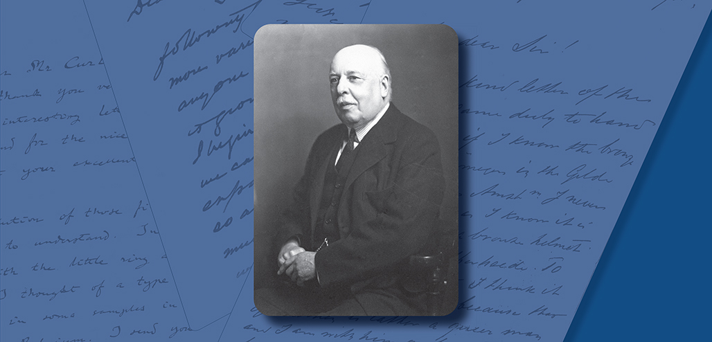
Iain Ferris is an independent academic researcher and a former field archaeologist who has published three archaeological excavation monographs and ten books, the most recent of which, Visions of the Roman North: Art and Identity in Northern Roman Britain, was published by Archaeopress in 2021.


A Map of the Body, a Map of the Mind: Visualising Geographical Knowledge in the Roman World by Iain Ferris

This study considers the relationship between geography and power in the Roman world, most particularly the visualisation of geographical knowledge in myriad forms of geography products: geographical treatises, histories, poems, personifications, landscape representations, images of barbarian peoples, maps, itineraries, and imported foodstuffs.

Forthcoming (Spring/Summer 2024)
ISBN 9781803277813 | Paperback: £45.00
Pre-order at archaeopress.com and save 25%: Use voucher code 781325

From Photography to 3D Models and Beyond: visualizations in archaeology

Donald H. Sanders explores the history of visual technology and archaeology.

What would it be like to debate philosophy with Plato, walk around the dusty streets of old Babylon, watch 1000s of perfectly cut stones become an immense pyramid, or buy some pottery from a vendor in a bustling ancient marketplace? These are not (entirely) fantasy or science fiction time-travel musings (Figure 1).

Figure 1. Rendering from the virtual reality interactive computer model of a neighborhood in ancient Roman Byblos c.300 BCE; image © 2023 Learning Sites, Inc.

How do we know about the past? What is archaeology? Is it the collecting of information about the past? Or is it also the interpretation and understanding of the peoples and cultures of the past?

Ancient texts are very informative; so are the artifacts and buildings that survive from long-eclipsed cultures. When we find an object buried in the ground, we begin to imagine how old it might be, how it was used, who owned it, and how it got to that particular spot. For millennia, people have wondered those same things and seem to have been collecting their found objects. Trying to link things chanced upon with the people, places, and periods from which they originated has gone hand in hand with the collection of those objects. Ancient Egyptians, Assyrians, Chinese, Greeks, and Romans, for example, all gathered objects from their past and all thought about how they connect to their present, who were their ancestors responsible for creating them, and what do they tell us? 

Collecting was originally a personal thing. By the 3rd millennium BCE, collecting of exotic items, valuable or rare items, and items with writing on them became the province of royalty, especially while on campaigns in foreign lands. Collecting brought prestige and power, not to mention wealth and status. At what moment the mere accumulating of things turned toward specifically seeking to learn about the cultures who produced the objects is an inquiry difficult to discern looking far back into the distant past. There are inklings of that inquisitiveness during the early 1st millennium BCE. Cataloguing and inventorying the amassed collections necessitated the inclusion of images to facilitate trading items or to show off the best stuff to friends, colleagues, and rivals. Thus, the visualization of collected items became important when the collection became more public. Over time, the more public the collections became, the more illustrations were deemed essential, as for selling, teaching, or publishing.

Collecting, visualizations, and looking backwards have long been associated with antiquarian tendencies. The discipline of (modern) archaeology has been, also, very generally defined as the study of the physical artifactual remains of human existence. So, is it also all about finding and collecting old stuff? Or, can we set it apart as a profession by presuming that it is more about trying to figure out how peoples of the distant past interacted, lived in the spaces we uncover, and coped with the kinds of daily dilemmas that we still deal with today (through analysis of the tangible remains they left behind)? If it is about understanding ancient cultures, then archaeologists must still come to grips with all the artifacts (tools, pots, coins, hearths, sculpture, rooms, buildings, and settlements) that survive from those ancient peoples. Archaeologists’ responsibilities lie well beyond just collecting things and include documentation, analysis, research, teaching, and publishing in order to pass along their evidence, hypotheses, and conclusions to colleagues, students, and the general public. To help accomplish those goals, archaeologists rely on images of their fieldwork, finds, and investigative results. The types of images chosen both reflect the nature of the discipline at the time and adhere to contemporary technologies and standards.

Though it is a fine distinction, a discipline of scientific archaeology perhaps becomes distinct from antiquarianism or prestige collecting when actions go beyond gathering and display and instead encompass empirical evidence-backed inquiries about the lives, settlements, and cultures of the people responsible for the objects.

Though understanding the distant past of those people is not easy, we have ways to partially overcome that and provide scholars, students, and the general public with a near-first-person experience of any moment in history—to see ancient places from the point of view of the original inhabitants. We can build that virtual time machine and travel back to move through and thus better know the past, which may even help us craft a better (more tolerant) future. Such an opportunity alone should warrant discipline-shifting action on the part of the great thinkers of our time, or, at least, by historians, schoolteachers, and museum personnel. Yet, despite a quarter century of demonstrable benefits across domains, new media technologies such as virtual reality, augmented reality, and related interactive computer-graphics technologies (that underlie digital time travel) have been underutilized not only by all manner of archaeologists, in their quest to more accurately interpret artifacts, architecture, and cultural change, but also by educators in their quest to more actively engage knowledge-hungry students and globally dispersed colleagues.

Lush, detailed, accurate, and precise depictions of ancient settlements are not eye candy, not mere pretty pictures of the past (as photographs were, and digital reconstructions still are, too often categorized). Instead, interactive 3D digital reconstructions are visualizations crucial to truly grasping the complexities of (diachronic and synchronic) culture change by allowing us to witness and study the people, events, and cities of the past as if we were actually there, looking through the eyes of those who lived that past and constructed those built environments.

Architecture both determines behavior and is created based on behaviors that reflect cultural conventions. Therefore, studying ancient built environments becomes very important for understanding the past, and how we visualize ancient architecture influences our study of it. Plans, sections, and elevations have been the traditional modes of visually representing architecture (and artifacts) for millennia (Figure 2).

Figure 2. Images of how various ancient cultures depicted architecture; image composited and © 2024 by Donald H. Sanders

The relevance of those image types was reiterated during the Renaissance when both treatises about architecture and a renewed interest in the ancient world blossomed. A comfortably conservative continuity in the history of the discipline (which persists in classrooms and fieldwork today) has dampened archaeologists’ inclinations to accept new image types and media to document, record, research, and disseminate their findings about the past. When scientific archaeology was being codified during the 19th century, it coincided with Classical revival styles in contemporary architecture which in turn relied upon the plans, sections, and elevations of ancient buildings published by antiquarian travelers around the ancient world. Since many of the key early archaeologists were themselves trained as architects, it is natural to see how the sacred triad of drawings became embedded in their work and persisted for so long. Those three image modes, used for millennia and honed for the architecture profession, limit the way we see the past. Yet, plan-section-elevation continues to be unquestionably repeated by archaeologists for illustrating finds during excavation, for teaching, display, and publication despite numerous alternative and perhaps more illuminating visualization types.

Also, during the 19th century, the introduction of photography into archaeology (much like the introduction of interactive 3D computer graphics into the field in the late 20th century) offered unprecedented ways to capture and investigate the remains of ancient civilizations (Figure 3).

Figure 3. Upper image: photograph of the ruins on the Palatine Hill, Rome, photographer unknown, dated c.1860, https://tinyurl.com/2mb9a77b, viewed February 15, 2024.
Lower image: rendering from a 3D computer model of the inner courtyard of Domitian’s palace on the Palatine, image © 2021 Learning Sites, Inc.

There are many parallels between the trajectory of integration of photography (from the early 19th century into the mid-20th century) and of 3D computer modeling (from the late 20th century into the early 21st century) into archaeological fieldwork and publication. The simultaneous (and often mutually reinforcing) rise of photography and archaeology during the early decades of the 19th century encompass many events and trends that interwove and continue today to define image-capture methods during fieldwork (whether for survey, travel, or excavation). Comments about the limitations and promised advantages of photography for all aspects of archaeology by early adopters and antiquarian travelers are echoed in nearly exactly the same words used regarding virtual heritage techniques. And both image modes found only gradual acceptance into the discipline. It took nearly 150 years before practical standards for using photography in archaeology became widely accepted turning photography into the unquestioned image-capture, documentation, and publication technique. Despite established advantages, the same has not yet happened with interactive 3D computer graphics, despite nearly 50 years of benefits to other related disciplines. The arc from introduction toward eventual inclusion of interactive 3D computer modeling into all aspects of archaeology is a narrative still unfolding but looking back over its first 30 years provides some analogies with how photography was absorbed into the discipline and may provide additional clues to why it is taking so long for archaeologists (and museums and teachers) to adopt the exciting digital means of immersing oneself in the past. Still lacking for computer graphics are both a firm and favorable pronouncement by a respected member of the community and dramatic changes to publishing techniques and venues to allow for the inclusion of virtual worlds.

There are many examples that demonstrate when a new visually based technology emerges to replace an older one, there is a certain user-approval curve until the new technology finds its own visual vocabulary. Until that happens, dependence on the image norms of the previous technology helps ease the newer mode toward wider acceptance. We may still be in that transition period whereby interactive 3D computer graphics seek their own identity, distinct from hand-drawing, drafting, and rendering. Many types of new and not-so-new technologies are vying for archaeology’s attention, most of which have been in use by virtual heritage practitioners since the early 1990s, but many more are emerging all the time. Archaeology has a long tradition of absorbing other discipline’s approaches and tools into its own analytical processes (e.g., statistics, C14 dating, LiDAR, GIS, and photogrammetry). Virtual reality, augmented reality, mixed reality, generative AI, and high-end 3D modeling programs have yet to fully undergo similar assimilation. They offer fieldworkers the ability to move beyond collecting things toward using those found objects to re-create an accurate, precise, detailed, and vibrant past complete with intelligent digital characters each of whom could answer questions posed to them by virtual visitors so that archaeologists could test all kinds of new and much more complex hypotheses than ever before about settlement growth, building function and decay, and object use.

These new interactive pasts can be experienced through online collaborative portals. Once features like immersive social media discussions, real-time excavation databases, and globally accessible first-person digital learning modules are added, an entirely new discipline of archaeology begins to emerge. Birthing a new discipline today is not unlike what happened in the mid-19th century after the advent of photography. Given what could be accomplished today, with technologies both in existence and on the horizon, the final chapter of From Photography to 3D Models and Beyond: visualizations in archaeology lays out envelope-pushing ideas about how to improve archaeological fieldwork, teaching, and data dissemination, as I extrapolate from the trends and history outlined in earlier chapters (Fig. 4).

Figure 4. Screen grab from a hypothetical webpage showing one future for archaeological data dissemination; image © 2023 Donald H. Sanders.

If archaeology is really not just about collecting old things, but more about learning how ancient peoples lived, how the spaces and objects found were used, and how history unfolded, then it would seem in its best interest to utilize visualization tools that help achieve those goals as accurately as possible. How the history of architectural visualizations in archaeology have conditioned and pigeonholed how the profession works today and why the discipline has yet to fully embrace new interactive digital technologies are themes explored in my book.

Thus, yes, we can debate philosophy with Plato, walk around the dusty streets of old Babylon, watch 1000s of perfectly cut stones become an immense pyramid, and conduct business with a vendor in an ancient marketplace. Archaeologists (and teachers, and museum outreach program coordinators, and directors of archaeological site visitors’ centers) have the tools today to make that happen, to test their hypotheses about how the past worked, and ask new and previously unimagined questions about history, cultural development, settlement growth, and architectural change. Our understanding of the past is not conditioned by the questions we ask but by the visualizations chosen to illustrate the answers.


Sincerest thanks to Donald H. Sanders for providing this post for the Archaeopress Blog. Full details of Donald’s book can be found below.

If you would like to contribute an article to the Archaeopress Blog, please contact info@archaeopress.com.


From Photography to 3D Models and Beyond: Visualizations in Archaeology

By Donald H. Sanders

This book explores the history of visual technology and archaeology and outlines how the introduction of interactive 3D computer modelling to the discipline parallels very closely the earlier integration of photography into archaeological fieldwork.

Paperback: £36.00 | PDF eBook: £16.00

Revealing Trimontium

Donald Gordon provides the background of the recently published volume presenting the correspondence of James Curle of Melrose, excavator of Newstead Roman Fort

James Curle c. 1890.
By courtesy of the family.

In the wake of  two Public Inquiries in 1989 and 1990 about the sending of the third phase of the Melrose Bypass along an old railway line through the South Annexe of Trimontium fort, the Trimontium Trust was set up by local enthusiasts to pay honour at last to James Curle, the Melrose solicitor, who had led the excavation of the fort in 1905-10 and published his magisterial 450 page report A Roman Frontier Post and its People in 1911.

There followed a number of activities over thirty years including the establishment of the Trimontium Museum, a ranking membership of a notionally-revived Twentieth Legion, and a series of seasonal site walks, talks, work with schools, outings and an annual newsletter, the Trimontium Trumpet.

The fort area today, approached from the west, sitting on the plateau where the line of trees runs.
© Fraser Hunter.

Fraser Hunter was our link man with the National Museum, Scotland; Phil Freeman of Liverpool University came to lecture on Francis Haverfield, Camden Professor of History at Oxford and Curle’s mentor; and Lawrence Keppie of Glasgow University suggested that we should gather together the writings of James Curle, beginning with a cache of his letters to Haverfield during the excavation, which was housed in the Ashmolean Museum, Oxford and which the writer duly visited, copied and photographed in Autumn 1998.

A consultation in Historic Scotland HQ, Edinburgh, of aerial photographs of the Trimontium site, accidentally led to the discovery of a number of James Curle letters previously sent up, to a more appropriate home, it was suggested, by Dafydd Kidd, a member of the British Museum staff. The writer wondered if that seam of Curle letters had been fully mined and in pursuit of that search via a succession of train journeys to London was welcomed to peruse and copy the correspondence which James Curle had maintained with the British Museum for forty years, from 1891 to 1931.

Curle’s passport. Photo by Donald Gordon, reproduced by courtesy of the family.

That second batch of correspondence was increased by a further collection, mostly from the Continent once his report made him famous, discovered by the Curle family when a Scottish Borders holiday house was being cleared. These, together with Curle’s Victorian passport showing him an international traveller and museum visitor, led to the tracing by Fraser of even more letters and Curle quotations by other archaeologists in the Europe Dept of the BM.

It was Fraser who suggested correctly that Archaeopress might be interested in publishing this material, illustrative of the working methods of the early archaeologists, and linking it to that vast array of contacts which James Curle used to gather the information on which his report was based.

The project, began with enthusiasm, developed with serendipity, extended with the cooperation and kindness of individuals, was brought to completion in 2023 with the skill of professionals and is an object of pride and congratulation by those who appreciate the work of James Curle.

Donald Gordon and Fraser Hunter at a book launch event in November 2023.

Sincerest thanks to Donald Gordon for supplying this blog post.

Revealing Trimontium

The Correspondence of James Curle of Melrose, Excavator of Newstead Roman Fort

Edited by Donald GordonFraser HunterPhil Freeman

The Roman fort of Trimontium is renowned internationally thanks to the work of James Curle (1862–1944) who led the excavations of 1905–1910. This volume brings together key sets of his correspondence which cast fresh light on the intellectual networks of the early 20th century, when professional archaeology was still in its infancy.

Paperback: £35.00 | PDF eBook: £16.00

Available now at www.archaeopress.com

History of the Limes Congress

Dr Tatiana Ivleva, University of Newcastle, and Dr Rebecca Jones, Historic Environment Scotland, celebrate the 25th International Congress of Roman Frontiers Studies and highlight the important role women have played since the very beginning.

To celebrate the 25th International Congress of Roman Frontiers Studies (Limes Congress) to be held in Nijmegen in August 2022, the authors, together with Professor David Breeze and Dr Andreas Thiel, have put together a history of the Congress, from the early ideas of such a gathering in the interwar years through to the first Congress held in Newcastle in 1949 and on to the present day.

In many ways, the research for the book has been a labour of love by the authors – the Limes Congresses hold a particular affection by many of the attendees, as an opportunity for visiting the remains of Roman frontier sites around the empire, hearing about new research through lectures and posters, and networking with colleagues who may be doing similar research but in different countries.

Whilst it is unlikely that the organisers of the first congress of 1949 had a clue of the success to which their endeavours would ultimately lead (which now includes up to 400 participants from 25 countries from four continents; and three ‘Frontiers of the Roman Empire’ World Heritage properties); in many ways, the history of the 24 Congresses held thus far has held up a mirror to selected historical events of the last 73 years. Even the most recent three:

  • The 2022 Congress in Nijmegen was originally scheduled to take place in 2021 and has been delayed due to Covid. Very few scholars from the Ukraine and Russia are unable to attend following Russia’s invasion of Ukraine and the impossibilities for attendance at foreign conferences due to financial and travel restrictions.
  • The 2018 Congress in Serbia was a welcome return to that part of the Balkans following the cancellation of a proposed congress in the former Yugoslavia in 1992 due to the deteriorating situation there.
Participants in the 2018 Congress visiting the Roman fort of Diana in Serbia.
Copyright: Nemanja Mrđić
  • The 2015 Congress in Ingolstadt in southern Germany was at that point in time when there was a mass influx of Syrian refugees across Europe, resulting in the closure of land borders and delays in delegates reaching Bavaria.

One noticeable factor in the Congresses has been the increase in attendees and numbers of speakers. This includes a rise in the number of women speaking, although the gender disparity on the topics discussed is a notable aspect which we explore briefly in the book.

But perhaps one aspect of the research on the book that engaged us most was learning more about those scholars that we only knew as authors of esteemed volumes on the archaeology of Roman frontier regions, and then identifying them on group photographs from the Congresses. Following the description of each Congress in the book, we have a few short reminiscences by one or two participants for whom that Congress was their first immersion into the world of limes studies or otherwise noteworthy. Each Congress note is supplemented by a series of photographs, not of monuments visited during the Congress excursions (as these can be easily found online) but of people visiting particular sites, and social events such as receptions, dinners and informal lunches. We believe that this exercise not only gives an opportunity for the reader to put a face to a name, but also to learn more about limes past, present and future stalwarts’ characters, ambitions and interests.  

Specifically, it has been a particularly delightful quest to try to name every individual on a group photograph from the First Congress in 1949 in Newcastle.

That first Congress followed the centenary Pilgrimage of Hadrian’s Wall, and the publication of the Congress proceedings tells us that there were 11 speakers (10 males and one female). There was a reasonable spread of geography covered – in part due to international schools of archaeology and colonial occupations.

Copyright: Tullie House Museum and Art Gallery

Yet a photo of that Congress, featuring 38 people, tells perhaps a slightly different story than that told in the proceedings. And this led the authors onto a hunt to identify the participants on the photograph – particularly the nine women depicted. Two women known to have been at the Congress – Anne Robertson from Glasgow (the sole female speaker) and Brenda Swinbank (later Heyworth) – are not in the photograph. This thereby suggested that there were at least 11 women present at the Congress, potentially over 25% of the delegates. We didn’t feel that a simple dismissal of ‘wives and other family’ was sufficient and are pleased to say that our endeavours paid off.

In the front row of the photograph, seated on the ground, are two women: Elisabeth Ettlinger and Barbara Birley.

Elisabeth Ettlinger, then 34, was a German-born archaeologist, who had fled Germany for Switzerland in the 1930s. She joined the classical archaeology department at Basel University and received her PhD in 1942 on the subject of the pottery found in thermae of Augst (published in 1949). Her work Die römischen Fibeln in der Schweiz (1972) still acts as an essential reference book for the study of Roman brooches and she was one of the founders of the Fautores (the Rei cretariae Romanae fautores – Roman pottery studies: https://www.fautores.org/) which met for the first time after the Third Limes Congress in Switzerland in 1957. Elisabeth sits next to Dutch archaeologist Willem Glasbergen and, whom we think was the American-born Roman archaeologist and Latin philologist Howard Comfort. Both were life-long friends with Elisabeth, sharing their love for the Roman pottery, and it was with Howard that the idea for the Fautores was born (Howard is another co-founder).    

Barbara Birley, sister of Eric Birley, sat alongside her brother and was a teacher in South Africa. She and Eric remained close, and she was interested in Roman archaeology so would regularly return to visit family at the same time as a major Roman event such as the Pilgrimage.

In the very back row, between Antonio Frova (from Italy, who spoke about Bulgaria) and Mortimer Wheeler (from Britain and spoke on Mesopotamia) is the tall blonde figure of Dutch anthropologist Guda van Giffen-Duyvis. Although her husband Albert Egges van Giffen spoke at the Congress, Guda attended the Hadrian’s Wall Pilgrimage and was a scholar of Aztecs and pre-Columbian art of Mexico and Peru.

In front of Guda is a line of six women, of whom we have been able to identify three. The lady in the hat on the left is unknown but to the right of her in the spotted dress is Margerie Venables Taylor, who was the Secretary of the Society for the Promotion of Roman Studies for a great many years and editor of the Journal of Roman Studies. She would have graduated from Oxford University, but they didn’t award degrees to women when she studied there! She was later Vice President and President of the Society for the Promotion of Roman Studies and later became the first woman to hold office as Vice President of the Society of Antiquaries of London.

We don’t know the name of the woman to the right of M V Taylor, nor the lady with the dark hair in the dark suit to the right again. Although Dorothy Evelyn ‘Eve’ Dray (later Simpson) has been suggested for the latter, this lady wears what appears to be a wedding ring and Eve didn’t marry until 1952. But we have been able to identify the two ladies on the right hand side of this line up. In the cardigan with spectacles is Jocelyn Toynbee, the leading British scholar in Roman artistic studies and a lecturer at Cambridge University. Two years later, in 1951, she became the first (and, so far, only) female Lawrence Professor of Classical Archaeology at Cambridge. To the right of Jocelyn is (Mary) Grace Simpson, who trained as an archaeologist after the war (graduating from the UCL Institute of Archaeology in 1948) and subsequently became a research assistant to Eric Birley at Durham. Her father was the archaeologist F G Simpson who played a key role in Hadrian’s Wall studies, particularly as director of excavations at Birdoswald in 1929. Grace developed significant expertise in Roman pottery, co-authoring an essential reference volume on Samian ware (Central Gaulish Potters) in 1958, and was Honorary curator of the Clayton collection at Chesters on Hadrian’s Wall. Like Elisabeth Ettlinger, she later played a key role in the Fautores Congresses.

It is notable that many of the women we have been able to identify were already, or became, significant figures in their various fields of research on Roman provinces and frontiers. It is possible that several already knew each other due to their work on Roman Britain and we can assume that they were potentially personally invited, with the younger generation there by the invitation of their supervisors. For example, we know that 26 year old Dutchman Willem Glasbergen, seated second from left, went at the invitation of his supervisor, Albert van Giffen (not pictured, and known to have had his leg in plaster at the time).

When we started our quest, we had an assumption that people featured were prominent figures in Roman provincial and frontier studies and we were correct there as well. Other people that we have been able to identify in the photograph are familiar names in Roman and Classical archaeology and material culture studies:

Front row, seated: Howard Comfort (?), Willem Glasbergen, Elisabeth Ettlinger, Barbara Birley, Eric Birley, Ian Richmond, Andreas Alföldi, unknown, Franz Oelmann.

Standing in the middle row: third from the left, not looking into the camera is Rudolf Laur-Belert, Georg “Gyuri” Kunwald (?); centre behind the seated Eric Birley is Canon Thomas Romans; three to the right of him, Margerie V Taylor, three again, Jocelyn Toynbee and then Grace Simpson.

Standing in the back row: centre back behind the lady with the hat is Jean Baradez, to his right is Hans Norling-Christensen; to his left is Antonio Frova, then Guda van Giffen-Duyvis, Mortimer Wheeler and Victor Erle Nash-Williams.

Many Congress participants are wearing the round 1949 Hadrian’s Wall Pilgrimage badge showing how many had been on the Pilgrimage prior to the Congress. We believe that Shimon Applebaum and Ulrich Kahrstadt should be in the photo but have been unable to identify them.

We would welcome any assistance in identifying the people on this photograph!

This book about the Congress history is more than a trip down memory lane: we believe it shows how a discipline of Roman frontier studies was born and developed facing various challenges along the way. If it were not for the existence of the Limes Congresses, the iconic Roman frontiers sites might not have received the visibility they deserve nor would they have enjoyed their inscription on World Heritage list. The discipline is thriving, despite the alarming disappearance of faculty positions at Universities across Europe with a focus on Roman provinces and frontiers. We hope that our readers will appreciate the significance of the Roman frontier studies and our discipline’s contribution to the understanding of life in Roman world outside the Mediterranean core.

Dr Tatiana Ivleva, University of Newcastle, and Dr Rebecca Jones, Historic Environment Scotland


Sincerest thanks to Dr Ivleva and Dr Jones for contributing this article to the Archaeopress Blog.

A complimentary copy of the A History of the Congress of Roman Frontier Studies 1949-2022 will be presented to all those attending the 25th International Congress of Roman Frontiers Studies (Limes Congress), Nijmegen later this month. For those not attending the conference, the book will be available to purchase in paperback (priced £38), or downloaded free of charge in Open Access from 25th August 2022. Pre-order the book on the Archaeopress website here.

Save 25% on our whole collection of books and eBooks at www.archaeopress.com by applying the following voucher code to your basket before checkout: LIMESXXV

Browse our website or download our dedicated flier for the LIMES congress, highlighting the specialist series and titles within our Roman collection.

Georgian Archaeological Monographs

Dr Paul Everill, University of Winchester, introduces a new monograph series from Archaeopress

Cover image: Aerial view of excavations at Nokalakevi © National Agency for Cultural Heritage Preservation of Georgia

What’s your connection to Georgia?

I have been co-directing archaeological work at Nokalakevi, as part of a wonderful collaborative team, for almost 20 years. My work in Georgia began, completely by chance, when I worked with Nick Armour at the Cambridge Archaeological Unit in autumn 2001. He had just returned from Nokalakevi with Ian Colvin and a handful of Cambridge students after the inaugural season of the Anglo-Georgian Expedition, and could talk about little else. It sounded amazing and I couldn’t resist the opportunity to get involved. I travelled to Georgia in 2002 expecting it to be a fun and exciting busman’s holiday, supervising students in a new trench at Nokalakevi before starting my PhD at Southampton. I was simply unprepared for the impact that Georgia was to have on me. Evidence of its deep, proud, but not always easy, history seems to be in every corner of its stunning landscape, written across the Colchian plain, along the towering Caucasus mountains, and in the DNA of its people. Back then Georgia was only just recovering from the first difficult years of independence. The dig house bore the scars of automatic weapon fire, and we would occasionally hear gunfire and explosions. The local governor provided armed security to ensure our safety. But actually those aren’t the aspects that made the greatest impact, it was the immersion in Georgian culture. Its food, while of course demonstrating some external influence, is uniquely and undeniably Georgian; and its wine, the grapes and the vines that bear them, seem to have an unbreakable, sacred bond with every Georgian. There is something magical about a country that wears its heritage so openly, and in which intangible cultural heritage is so vibrant and alive, but the warmth and hospitality of the Georgian people also had a profound impact on me.

Supervising students working in Trench A, Nokalakevi © Paul Everill

How has the ‘Anglo-Georgian Expedition to Nokalakevi’ lasted so long?

There are certain magic ingredients that give some field projects longevity. One is undoubtedly that we operate a funding model that gives us independence from the whims of funding bodies, so the project lifespan is not determined by the usual three year grant cycles. Our longevity is determined by the quality and scale of the archaeology at the site, not by the subjectivity of committee decisions. The other factor is that our expedition is genuinely underpinned by friendships. It’s not something that you can plan for, but from the point at which Ian Colvin and Davit Lomitashvili first discussed the idea of an Anglo-Georgian Expedition to Nokalakevi, it has gone from strength to strength because of mutual respect, shared ideals, and friendship. Today, as well as Ian and Davit, I am fortunate to work alongside Nikoloz Murgulia, Besik Lortkipanidze, Nino Kebuladze and many others who are friends as much as they are colleagues.

Trench A, Nokalakevi, taken from the air © National Agency for Cultural Heritage Preservation of Georgia

What was the rationale for establishing a Georgian Archaeological Monographs series?

Until the pandemic impacted on our (and everyone’s!) plans, we had been working towards publication of our second expedition monograph, reporting on excavations at Nokalakevi from 2011-2020 and discussing some of the key research themes from our work. Of course our 2020 field season was impacted, along with the opportunity to meet in person and talk through the chapters. In the meantime I had also been thinking about finding a route for publishing the proceedings of a session on the archaeology of the region that I’m co-organising for September’s EAA conference, and it occurred to me that having a dedicated monograph series would make the perfect home for these publications, and for all those who are working on the archaeology of the region at various career stages, alongside the opportunity to provide researchers from the South Caucasus the opportunity to publish in a western language. One of the challenges of writing up research on Georgian archaeology can be the accessibility of source material if you don’t read Georgian or Russian. I have been incredibly fortunate to work collaboratively with Georgian specialists who provide English translations of relevant excerpts of Georgian scholarly work and references, and of course also bring their expert knowledge of Georgian academic traditions and the theoretical frameworks that this work inhabits. Generally, however, western academics are only able to access a small percentage of the published work on any given site, and without much of the supporting context. I want this series to start bridging this divide.

It seems to me that the South Caucasus is sometimes treated as rather liminal by western archaeologists – a place where the more studied empires and civilisations enact change, or leave evidence of their economic and military activities, but perhaps not an area deserving of study in its own right. Its higher profile in the west today probably owes as much to conflict in Syria and Crimea, which has forced a range of international projects to relocate to more favourable locations, as it does to greater awareness. The archaeology of the South Caucasus, however, is more than deserving of its own spotlight and I really hope that this monograph series can provide a stage.

Dr Paul Everill, University of Winchester
Paul.Everill@winchester.ac.uk

The Archaeopress series announcement is below, or can be downloaded as a PDF here. The series homepage carries brief details for the first volume, Nokalakevi – Archaeolopolis – Tsikhegoji: Archaeological Excavations 2011-2020 (forthcoming)

Public Archaeology: Arts of Engagement

Professor Howard Williams, University of Chester, introduces his co-edited volume stemming from the 2nd University of Chester Archaeology Student Conference, April 2017.

How should communities be engaged with archaeological research and how are new projects targeting distinctive groups and deploying innovative methods and media? In particular, how are art/archaeological interactions key to public archaeology today?

9781789693737We proudly present the brand-new book: Public Archaeology: Arts of Engagement, appearing in the fabulous Archaeopress Access Archaeology series.

There remain surprisingly few edited collections in the field of public archaeology. Building on recent work, including the edited collection from 2015 Archaeology for All:  Community Archaeology in the Early 21st Century edited by Mike Nevell and Norman Redhead, and Gabriel Moshenska’s edited collection: Key Concepts in Public Archaeology, this new book helps to extend and expand critical discussions. It provides an outlet for an original and distinctive mix of fresh perspectives and approaches, specifically addressing art/archaeological intersections in public archaeology’s theory and practice. Our book focuses on UK perspectives and practices in public archaeology, although we feel many of the themes addressed are of global significance.

How did it come about?

poster2Following the 2nd University of Chester Archaeology Student Conference, 5 April 2017, Dr Caroline Pudney and I teamed up with former student Afnan Ezzedin to take the research presented forward to publication. We have crafted a proceedings which combines distinctive and select contributions from (undergraduate and Masters) archaeology students together with a range of original investigations and evaluations from academics and heritage practitioners.

For me, this has taken a huge amount of time, energy and personal sacrifices to get this done over the last 31 months or so. I’d also like to point out that this is part of a series of edited collections stemming from the Grosvenor Museum student conferences. I’ve now produced 2 of the 5 student conference volumes I’ve committed myself to. The first – The Public Archaeology of Death was out in January 2019. The third – Digging into the Dark Ages: Early Medieval Public Archaeologies – will be out in early 2020. The fourth is in production: The Public Archaeology of Frontiers and Borderlands.

What’s inside?

There are 22 contributions all told by 26 authors; many chapters are supported by colour illustrations.

Sara Perry writes an insightful and personal Foreword, using her own experiences as a means on reflecting about how we write critical public archaeologies which take our practices in new directions. Following this, there are two chapters by me. The first is an introduction which surveys pertinent themes and issues in public archaeology and art/archaeology interactions in particular, and the second, written to showcase the student presentations incorporated into the book as well as those that were not, reviews the conference and the development of the book.

The main body of the book is split into 3 sections. ‘The Art of Engagement: Strategies and Debates in Public Archaeology’ contains 8 chapters exploring different ways in which strategies are being deployed in public engagement and how we evaluate our practices. For example, I have co-authored a chapter in here which draws on the conference paper and essay by Rachel Alexander; we evaluate the much-lauded Operation Nightingale’s dialogues with early medieval warriors.

The second section – ‘Arts in Public Archaeology: Digital and Visual Media’, incorporates 6 chapters, each exploring different means of public engagement and evaluating their potential and challenges. My chapter in this section, for example, critically reviews my Archaeodeath blog from its inception in 2013 to the end of 2018.

The third and final section – ‘Art as Public Archaeology’ – has 4 chapters, considering different visual media as subject and strategy for public and community projects.

The Afterword by Dr Seren Griffiths identifies that all archaeology should have a ‘public’ dimension, and that creativity and playfulness must be key ingredients of good public archaeology.

Tell your friends, colleagues and libraries…

Afnan, Caroline and I hope you enjoy the book and appreciate its availability via open access as well as to acquire in print. The book is available now via the Archaeopress website, available to buy as a hard copy or download as a pdf free of charge.

Click here for a flyer offering 20% off a printed copy.

Libraries at least should definitely have physical copies to complement the online ones I think! Also, in case you weren’t sure, archaeology books as Christmas presents are definitely a thing!

Acknowledgements

educate-north-awards-2019-winner-badgeI duly acknowledge the hard work of the students and colleagues in facilitating the conference. I also recognise the help and camaraderie of my co-editors Caroline and Afnan, the enthusiasm and contributions of the authors, the generous guidance of so many of my fellow archaeologists, the critical insights of the peer-reviewers, and the steadfast support of Archaeopress. Together this team has shown commitment in creating a high-quality peer-reviewed academic publication with no funding and sparse other support. I’m therefore very proud that these conferences and their publications are recognised as a positive thing: it was great to receive the 2019 Educate North Teaching Excellence Award as a result.

The book is dedicated to the memory of Dr Peter Boughton FSA, Keeper of Art for West Cheshire Museums who had worked hard to facilitate the conferences taking place at Grosvenor Museum as public free day conferences in the heart of the city of Chester.

Header photo: The Heritage Graffiti Project during creation. Photograph: Ryan Eddleston.

Sincerest thanks to Howard for providing this article for the Archaeopress Blog. Public Archaeology: Arts of Engagement is available now in print (£58) or as a free pdf download.

20191031_150717
A selection of Access Archaeology titles published since 2015.

Learn more about Archaeopress Access Archaeology in our recent article celebrating 100 titles in the range.

The Turkish Long-Necked Lute or Bağlama

Hans de Zeeuw introduces the tanbûr long-necked lute

In contemporary Turkey, the saz or bağlama, being a member of a large family of long-necked lutes called tanbûrs, is the core instrument of all folk musical ensembles and orchestras and a popular instrument in the arabesk, entertainment, and pop music in Turkey. The bağlama also plays an important role during the ceremonies of the heterodox sects of the Alevî and Bektaşî and among the âşıks, the Anatolian wandering poet-musicians, to accompany their partly religious repertory. The bağlama plays furthermore an important role in musical education to teach folk-music theory, notation, performance, and teaching of acoustics and instrument construction. Its importance is also testified by the fact that musicians, such as Arif Sağ, Musa Eroğlu, and Erdal Erzincan, play the bağlama as solo instrument on national and international concert stages.

The long-necked tanbûr, which appeared in literary and iconographic sources during the Sâsânian era (c. AD 224-651), diffused into the various musical traditions along the Silk Road, resulting in a variety of closely or distantly related tanbûrs with two or more, occasionally doubled or tripled courses, a varying number and variously tuned frets, each having its own characteristic sound, playing technique, and repertory. Similar or identical instruments are also known by other names, such as saz or bağlama, dotâr or dutâr, setâr, dömbra, and damburâ (FIGURE 1).

Plate Plate
Figure 1. Sâsânian silver plate showing a poet-musician playing a tanbûr, 5th–7th centuries AD (bottom left). Freer Gallery of Art, Washington.

The tanbûr arrived with the Seljuks in Anatolia in the eleventh century or even may be before. Possible intermediaries in the development of the Turkish saz instruments are the by Abd al-Qâdir Ibnu Ghaibî al-Marâghî in his book Maqâsid al-Alhân (The meaning of melodies, early fifteenth century) discussed tanbûr-i şirvânîyân (the tanbûr of Shirwân, located in the north of Azerbaijan) and the tanbûre-i türkî (the tanbûr of the Turks). The tanbûre-i türkî had, compared to the tanbûr-i şirvânîyân, a smaller pear-shaped body, a longer neck and two or three strings (FIGURE 2). Saz is a Persian word meaning musical instrument. It appeared for the first time in a work by Nezami van Gandja (1141-1209), one of the greatest poets in Persian poetry. In Anatolia we come across the word saz in the fifteenth century as a name for the tanbur of the travelling poet singers, the âşık, who were also called saz şaileri, poets with the saz.

Fliesen aus dem Kiosk des  Arslan II
Figure 2. Poet-musician playing a tanbûr in the usual cross-seated playing position of Central Asia with the neck pointed downwards, like the tanbûr players on the Sâsânian silver plates, on an excavated ceramic tile from the summer palace of Sultan Alâ al-Dîn Kayqubâd I, Anatolia, early 13th century. Museum für Islamische Kunst, Staatliche Museen, Berlin.

The origin of the name bağlama is still unknown. It could have been derived from the verb bağlamak (Turkish for to bind), the tying of frets around the neck or strings to the tuning pegs. The description of a saz with the name bağlama appeared in the second half of the 18th century in several European writings. Histoire générale, critique et philologique de la musique (1767) by Charles-Henri de Blainville (1711-1769), Reisebeschreibung nach Arabien und andern umliegenden Ländern (1774, 1778) by Carsten Niebuhr (1732-1815), and Essai sur la musique ancienne et moderne (1780) by Jean Benjamin de Laborde (1734-1794), who was sentenced to the guillotine during the French Revolution. De Blainville and Niebuhr were probably the sources of de Laborde. The bağlama was a small sized lute compared to the other lutes on the engravings of de Blainville, Niebuhr, and de Laborde (FIGURE 3).

FIG_3
Figure 3. Bağlama (3), bozuk (2), and iki telli (1) on an engraving from the Essai sur la musique ancienne et moderne of Benjamin de Laborde.

A few decades later we find the name bağlama as tanbour baghlama in another European writing Description historique, technique et littéraire des instruments de musique des orientaux of 1823 by Guillaume André Villoteau. Villoteau, who stayed in Cairo from 1799 until 1803 as a member of Napoleons Egypt-expedition, discussed several tanbûrs, which were mainly played by Turks, Jews, Greeks, and Armenians. In Lane’s time (1830s), tanbûrs were still ignored by native musicians in Egypt and only played by Greeks and other foreigners (FIGURE 4).

FIG_4
Figure 4. The Ottoman tanbûr (tanbour kabyr tourky) in the centre is flanked on the left by the tanbour charqy and the small tanbour boulghâry and on the right by the tanbour bouzourk and the small tanbour baghlama. Furthermore, in the foreground, a violin and a ‘ûd, engraving from the Description historique technique et littéraire des instruments de musique des orientaux (1823) of Guillaume André Villoteau.

We know from the Seyâhatnâme of Evliyâ Çelebi that sazs, which travelled with the Ottomans to the Middle East and the Balkans, were present at the Ottoman court and in the Turkish cities. Literary and iconographic sources as well as surviving instruments to reconstruct the history of the saz in the rural areas of Anatolia before the 20th century are scarce or absent. The separation between urban and rural culture was mirrored by the sophisticated courtly and urban sazs and the simple rural sazs, a situation that only increasingly changed after the establishment of the Republic of Turkey in 1923.

The proclamation of the Republic of Turkey in 1923 in Ankara had a major impact on the musical traditions and musical instruments of which the modernized and standardized saz became the most important instrument. In the 1930s musicologists started to construct a theory of folk music parallel to that of the Ottoman makam tradition. A body of modal structures, instrument tunings, plectrum movements, and rhythms were established through collection and notation inseparably linked to the saz. Moreover, the number of tied-on movable frets was, in imitation of the Ottoman tanbûr, increasingly expanded to create a larger tonal range. An earlier example of this practice can be found on a drawing of a saz from the Tefhîmü’l Makamat fi Tevlîd-in Neğamât (The concept of the makams in the making of melodies,  mid-18th century) of Kemânî Hızır Ağa.

Around 1940, the number of frets further increased, a development in which Mahmut Ragıp Gazimihâl (1900-1961) and Muzaffer Sarısözen (1899-1963) played an important role. This development took place around Radio Ankara and aimed to reform the music and musical instruments of the many regions, each with their own characteristics, into a coherent whole. For that purpose, choirs and orchestras were established, which performed uniform folk music on standardized sazs like those of Radio Ankara and Radio Istanbul.

Since the 1950s it became increasingly customary, starting in radio circles, to use the name bağlama instead of saz as a generic name for saz instruments. From literature we learn, however, that the traditional bağlama of Anatolia was a small saz. It is therefore obvious that not the small bağlama, but a larger saz was used to expand the number of frets. In contemporary Turkey, bağlama and saz are still used alternately.

FIG_5
Figure 5. Fret tuning (perde taksimati) of the long-necked bağlama (uzun saplı bağlama) and short-necked bağlama (kısa saplı bağlama) according to Cafer Açin.

Due to the modern entertainment industry and the changing taste of the audience after 1960, better trained musicians developed virtuoso playing techniques and set higher demands on technical and artistic issues such as the timbre and sound volume of their instrument, the method of stringing, and the number of frets and their arrangement on the neck. Around 1970 there was still a great variety in the number of frets and their tuning. Nail Tan concluded in Bağlama yapımı (Bağlama construction) that generally seventeen frets were used for the octave, but that the number of frets, among which non-diatonic ones, and their position on the neck was not yet standardized. Since second half of the 1980s, there seems to be some agreement. Sabri Yener in Bağlama öğretim metodu (Bağlama teaching method) and Irfan Kurt in Bağlamada düzen ve pozisyon (Bağlama tuning and vertical technique) both established seventeen frets in the octave, including five non-diatonic frets. Cafer Açin (1939-2012) established in Bağlama. Yapım sanatı ve sanatçıları also seventeen frets in the octave for the long-neck bağlama as well as short-neck bağlama (FIGURE 5).

The development of virtuoso playing techniques consisted of an increasing combination of vertical and horizontal playing techniques on the bağlama. In order to make an effective use of its vertical possibilities, the neck had to be shortened. By constructing a more pear-shaped bowl it was possible to lengthen the neck inwardly. In this way, the neck could be kept relatively short keeping the necessary space for the frets (FIGURE 6).

FIG_6
Figure 6. On the left, Muzaffer Sarısözen playing a ten-stringed of which the number of frets are expanded on the soundboard. On the right, the expansion of the number of frets on the neck by modifying the bowl of the saz.

Modern entertainment required, furthermore, the amplification of the sound. The bowl was therefore changed from a small U-shape to a larger and deeper U-shape with a soundhole (kafes) under the tailpiece (tel bağlama takozu) or, sometimes, in the soundboard. The soundboard changed from slightly arched and composite to a flat one made of a singular sheet of wood. For constructional reasons, the characteristic straight pegbox of the saz was replaced by a slightly angled attached pegbox. Moreover, on the first, third, and sometimes second course one of the strings was replaced by a so-called ‘bam teli’ or ‘octave’ string (brass-wrapped string), which was introduced towards the end of the 1950s by Neşet Ertaş (1938-2012) who was probably the last of the great bozlak (songs of agony) poet-musicians. These changes increased the soundvolume and changed the timbre. Moreover, the bağlama was amplified with electronic devices to facilitate playing in clubs or concert halls (FIGURE 7).

FIG_7
Figure 7. On the left, traditional saz. In the middle, morphological modifications of the soundbox, soundboard, and pegbox of the saz. On the right, contemporary long-necked bağlama.

The ongoing development of virtuoso playing techniques, combining the traditional horizontal playing techniques with vertical playing techniques, fuelled the development of the short-necked bağlama, being actually a long-necked bağlama with a shortened neck, an instrument suiting the combining of vertical and horizontal playing techniques. To distinguish the long-necked bağlama from the short-necked bağlama, the long-necked bağlama was called unzun saplı bağlama, the short-necked bağlama kısa saplı bağlama. The first experimental versions of the short-necked bağlama emerged after 1960. Musicians were, before Arif Sağ asked the luthier Kemal Eroğlu to develop a short-necked bağlama, not very interested in the short-necked bağlama. According to Kemal Eroğlu, the short-necked bağlama was derived from the long-necked saz/bağlama. According to Arif Sağ, however, the short-necked bağlama was not a new development but an older type saz type with a short neck. Some agree that there are certain similarities with the saz of the Alevî dedes.

The short-necked bağlama became after 1980, mainly under the impulses of Arif Sağ, a very popular instrument, particular in combination with the şelpe and parmak vurma technique (see accompanying video of Erdal Erzincan). An example is his virtuoso Teke Zotlaması, which was also played by Talip Özkan (1939-2010) on the long-necked bağlama as well as cura bağlama. Talip Özkan started in the 1960s to combine the traditional horizontal playing technique with vertical playing techniques on the long-necked bağlama tuned to the bozuk düzeni tuning, a tuning facilitating both techniques (FIGURE 8).

Figure 8. On the left, Arif Şağ playing şelpe on the kısa saplı bağlama during a concert in the Tropeninstituut in Amsterdam. Foundation Kulsan, Amsterdam. On the right, Talip Özkan playing a long-necked bağlama combining horizontal and vertical playing techniques.

Many folk musical genres can be played on the long-necked bağlama because it can be tuned in various ways. The short-necked bağlama has, on the other hand, a higher sound volume and can, because of its shorter neck and closely spaced frets, be played ‘easier’ and faster making use of all the three courses. Despite its popularity the short-necked bağlama did, however, not displace the long-necked bağlama.

Modernization and standardization resulted, furthermore, in the 1980s in the in the bağlama family (bağlama ailesi). Within the bağlama family different size categories can be distinguished, although no single classification is in general accepted and there are, moreover, also intermediate forms. A possible classification of the bağlama family, from small to large, is the cura, the short-necked bağlama (kısa saplı bağlama) and the long-necked bağlama (uzun saplı bağlama), the tanbura, the divan sazı, and the meydan sazı. The establishment of a nomenclature of the saz/bağlama family still has to be undertaken (FIGURE 9).

FIG_9
Figure 9. The bağlama family consisting of the cura, the short-necked bağlama (kısa saplı bağlama) and the long-necked bağlama (uzun saplı bağlama), the tanbura, the divan sazı, and the meydan sazı.

The systematic use of all three string courses and making a more effective use of the bağlama düzeni not only resulted in the short-necked bağlama but also initiated the development of instruments such as the dört telli bağlama (four course bağlama) and Oğur sazı, developed by the luthier Kemal Eroğlu after an idea of the musician Erkan Oğur. Both instruments are a continuation of the development of vertical and harmonic playing techniques (FIGURE 10, left).

Since the first six-stringed prototype from 1991, more prototypes were built like the thirteen-stringed and six-stringed Oğur sazı. In the meantime, various versions of the Oğur sazı were built by among others the musician and luthier Engin Topuzkanamış (Izmir) for other musicians like Efrén López and Guillermo Rizotto in Spain and Gilad Weiss in Israel (FIGURE 10, right).

Figure 10. On the left a four-course dört telli bağlama by Murtaza Çağır and ten-stringed Oğur sazı by Engin Topuzkanamış. On the right Engin Topuzkanamış playing a six-stringed version of the Oğur sazı in his workshop in Izmir.

An example of how the bağlama can inspire new forms is the divane of Yavuz Gül. Looking for a larger volume than the divan sazı, Yavuz Gül (Izmir) developed the divane, a family of hybrid instruments inspired by the long-necked bağlama and ‘ûd/lauta. The divane family consist of the efe divane, baba divane, divane deli, and the bass divane (FIGURE 11).

FIG_11
Figure 11. Three-course divane played by Yavuz Gül.

The exploration and development of vertical and harmonic playing techniques and a theory of Turkish harmony, for which the bağlama provides a model, will remain an important issue within Turkish folk music, notwithstanding attempts to standardization. Instrument makers do respond to the changes in the musical practice. This principle has dictated the evolution of music and instrument making for centuries.

FIG_12
Figure 12. Erdal Erzincan playing şelpe on a for this technique made four-stringed bağlama during a concert in the Centrale in Gent in 2017. The Centrale, Gent (Belgium).

Musical instruments are constantly changing and there is always room for improvement, innovation, and evolution. New bağlama types, of which the construction, the number of frets and their tuning, number of strings and their tuning, and playing technique vary, will therefore continue to evolve (FIGURE 12).

Further Reading

Bates, E. 2011. Music in Turkey: Experiencing Music, Expressing Culture (Global Music Series). Oxford: Oxford University Press.

Conway Morris, R. 2001. Bağlama, in S. Sadie (ed.) New Grove Dictionary of Music and Musicians 2: 469. London: MacMillan Press Limited.

Hassan, S.Q., R. Conway Morris, J. Baily and J. During 2001a. Tanbūr, in S. Sadie (ed.) New Grove Dictionary of Music and Musicians 25: 61-62. London: MacMillan Press Limited.

Sayce and T. Crawford 2001. Lute, in S. Sadie (ed.) New Grove Dictionary of Music and Musicians 15: 329-363. London: MacMillan Press Limited.

Spector, J., R. At’Ajan, C. Rithman C and R. Conway Morris 2001. Saz, in S. Sadie (ed.) New Grove Dictionary of Music and Musicians 22: 361-362. London: MacMillan Press Limited.

Stokes, M.H. 1993. The Arabesk Debate. Music and Musicians in Modern Turkey. Oxford: Claredon Press.

Zeeuw, J. 2009. De Turkse Langhalsluit of Bağlama. Amsterdam.

Zeeuw, J. 2019. Tanbûr Long-Necked Lutes along the Silk Road and beyond. Oxford: Archaeopress.

YouTube

Arif Sağ: https://www.youtube.com/watch?v=FPrTu3AWfuM

Talip Özkan: https://www.youtube.com/watch?v=ha5mAX1WaMM

Neşet Ertaş: https://www.youtube.com/watch?v=7yQI2mUX7Rc

Erdal Erzincan: https://www.youtube.com/watch?v=__ZGmCkB58I

9781789691696Sincerest thanks to Hans De Zeeuw for providing this article for the Archaeopress Blog.

Hans’ latest book, Tanbûr Long-Necked Lutes along the Silk Road and beyond (Archaeopress, 2019) is available:

Paperback, ISBN 9781789691696, £40

PDF eBook, ISBN 9781789691702, from £16+VAT

Available here:

https://tinyurl.com/9781789691696

Pioneering archaeological photography in John Alfred Spranger’s 1929-1936 photo reportages

Stefano Anastasio and Barbara Arbeid present the photo-archives of archaeologist and photographer John Alfred Spranger (1889-1968)

The importance of early photo-archives for archaeology

Early photo archives are becoming an increasingly important source of information for archaeology. This is, of course, a positive trend: any effort to make “forgotten” data available to the scientific community is to be welcomed.

Early photos may prove a powerful tool for protecting and promoting the value of archaeological heritage.

Hopefully, the current interest in early photo-archives will result in an increasing number of published archives. This will help archaeologists enhance their research, as well as the protection and conservation of the archaeological heritage.

John Alfred Spranger

John Alfred Spranger was born in Florence on 24 June 1889. His father, William, moved to Tuscany from England in the middle of the nineteenth century and was a professor at the Academy of Arts and Drawings in Florence. John Alfred was a leading figure in the cultural milieu of Florence at the beginning of the twentieth century. Both archaeologist and photographer (as well as engineer, topographer, mountain climber, art collector…), he was the author of several photo reportages detailing archaeological monuments and landscapes especially in Italy, Albania, Greece, Canada, Egypt, and Mesopotamia.

In 1913-1914, he participated in the Filippo De Filippi Expedition to the Himalayan Karakoram, as assistant topographer. The photographers of the expedition – Cesare Antilli, Major of the Italian Army, and Giorgio Abetti, a Florentine astronomer – systematically used cameras during the expedition, creating a real reportage, and Spranger surely gained a great passion for photography thanks to this expedition.

FIG_1
Fig. 1. Harry Burton at work in Deir el-Bahari (1929). The photo on the right corresponds to no. 4 marked on the map.

In the 1920s-1930s, he took part in a number of Etruscan excavations in Tuscany and paid great attention to the use of the camera to document the excavation work in progress. During this period, he spent time with Harry Burton, photographer of the discovery of the Tomb of Tutankhamun. It was, in fact, in Florence that Burton was hired as a photographer and archaeologist by Theodore M. Davis, who obtained the concession for the excavations in the Valley of the Kings in Egypt. During his stay in Florence, Burton spent time with Spranger and both were involved together in a number of Etruscan excavations. Their friendship is witnessed by Spranger in his Egyptian album, where Burton is portrayed in some photos taken in 1929 during the excavations at Deir el-Bahari (see fig. 1). Spranger died in 1968 at Newbury, in England, and was buried in Florence.

The publication of Spranger’s photo-archives

9781789691269The passion for photography accompanied Spranger for life. He took thousands of photographs, collecting them in refined photo-albums, consistent in shape, size and style, enriched by annotations, topographic maps and plans (most of the original stereograms were recently retrieved at the public library of Vaiano, a small town close to Florence where many documents from Spranger’s family are held today). On Spranger’s death, some albums, i.e. those dedicated to “archaeological subjects” were donated by his heirs to the then Superintendency of Antiquities of Etruria, and are currently held at the Photo-Archive of the Archaeological Museum of Florence. The volume published by Archaeopress presents the photos dedicated to a trip to Egypt in 1929 and a trip to Mesopotamia (Iraq) in 1936, as well as to some surveys and excavations carried out in Etruscan archaeological sites in Tuscany between 1932 and 1935.

FIG_2
Fig. 2. The map of the témenos of Ur (1936), with the photo perspectives and camera angles marked and numbered. On the right, photos corresponding to no. 3 (ziqqurat, from NE) and no. 8 (ziqqurat and courtyard of Temple of Nannar, from N).

Spranger’s photos are particularly meaningful, especially because he combined his skills in using the camera with a great expertise in archaeology and topography. He often glued maps of the sites he had surveyed on the albums, on which all perspectives and camera angles were marked and numbered (see an example in fig. 2). As a result of this, he was able to create outstanding “georeferenced” sets of photos for many archaeological sites: Giza, Heliopolis, Menphis, Saqqara, Beni Hasan, Abydos, Dendera, Medinet Habu, Karnak, Luxor, Thebes and Deir el-Bahari, in Egypt; Ur, al-Ubaid, Uruk, Nippur, Babylon, Ctesiphon and Birs Nimrud in Mesopotamia; the tholos of Casaglia, the tumulus of Montefortini and the necropolis of Casone, Riparbella, La Ripa in Tuscany.

FIG_3
Fig. 3. Excavation of a tomb at the necropolis of La Ripa, in Tuscany (1933).

Stefano Anastasio and Barbara Arbeid
Superintendency for Archaeology, Arts and Landscape – Florence
stefano.anastasio@beniculturali.it
barbara.arbeid@beniculturali.it

Cover photo: Page from an album dedicated to the temple of Seti I in Abido, Egypt. On the left is the temple plan, with perspectives and camera angles numbered so as to allow identification of the related photographs, in turn numbered and placed on the right page.

About the authors
Stefano Anastasio has carried out archaeological researches in Italy (Sardinia, Tuscany), Syria, Turkey, Jordan and currently works at the Archaeological Photo Archive of the Superintendency of Florence. His main research interests are the Mesopotamian Iron Age pottery and architecture, the building archaeology and the use of the early photo archives for the study of the Near Eastern archaeology.

Barbara Arbeid is an archaeologist at the Superintendency of Florence, appointed to the archaeological heritage protection service. Her main research interests are the archaeology of Norther Etruria, the Etruscan bronze craftsmanship, the archaeological collecting and photography.

Further reading

9781789691269Egitto, Iraq ed Etruria nelle fotografie di John Alfred Spranger Viaggi e ricerche archeologiche (1929-1936) by Stefano Anastasio and Barbara Arbeid. Archaeopress Archaeology, Oxford, 2019.

205x290mm; 178 pages; highly illustrated throughout in sepia and black & white. Italian text with English summary.

Paperback: ISBN 9781789691269. £35.00.
eBook: ISBN 9781789691276. From £16.00 (+VAT if appl.).

Also available from Archaeopress

9781784911188The 1927–1938 Italian Archaeological Expedition to Transjordan in Renato Bartoccini’s Archives by Stefano Anastasio and Lucia Botarelli. Archaeopress Archaeology, Oxford, 2015.

210x297mm; ii+242 pages; extensively illustrated throughout in black & white.

Paperback: ISBN 9781784911188. £40.00.
eBook: ISBN 9781784911195. From £16.00 (+VAT if appl.).

9781784914646Ceramiche vicinorientali della Collezione Popolani by Stefano Anastasio and Lucia Botarelli. Archaeopress Archaeology, Oxford, 2016.

170x240mm; vi+200 pages; illustrated throughout in colour and black & white. Italian text with English summary.

Paperback: ISBN 9781784914646. £34.00.
eBook: ISBN 9781784914653. From £16.00 (+VAT if appl.).

9781784910587Archeologia a Firenze: Città e Territorio Atti del Workshop. Firenze, 12-13 Aprile 2013 edited by Valeria d’Aquino, Guido Guarducci, Silvia Nencetti and Stefano Valentini. Archaeopress Archaeology, Oxford, 2015.

210x297mm; iv+438 pages; illustrated throughout in black & white. Italian text. Abstracts for all papers in Italian & English.

Paperback: ISBN 9781784910587. £58.00
eBook: ISBN 9781784910594. From £16.00 (+VAT if appl.).

The Value of Simulated Heritage in China

By Cornelius Holtorf, Linnaeus University, Kalmar, Sweden; Qingkai Ma, Zhejiang University, Hangzhou, China; Xian Chen, Zhejiang A&F University, Hangzhou, China; Yu Zhang, Zhejiang A&F University, Hangzhou, China.

Commercially driven copies are conventionally considered to lack relevance to heritage because they are of recent origin and lack heritage values. But for others, including us, heritage should be valued in relation, not to its origin, but to its function in society. In the past, research on cultural heritage has centered on material things which can be catalogued, listed, conserved. In the last decade, heritage has been redefined as an area that is concerned primarily with people. Heritage is now theorized as a range of cultural practices in which people invest meanings to things and ascribe values to them (Smith, 2006; Filippucci, 2009). Heritage is a process which creates new meanings and values, and the cultural meanings of heritage are validated through linkage to the past (Smith 2006). To date, research on the interactions of people, material things and relevant cultural processes is frustratingly scarce (Wells 2015).

Fig 1 IMG_3239
Figure 1. Geometrical perfection: view along the “Champs Elysees Shopping Street” towards the 1:3 scale-Eiffel Tower in Tianducheng, a suburb of Hangzhou, China. Photograph: Cornelius Holtorf 2018.

These issues can be illuminated further by the case of Tianducheng (Sky City), a simulated heritage site in Hangzhou, China. The city is a large suburb, which is designed to incorporate a selection of very prominent architectural heritage features from France including a 1:3 scale but nevertheless imposing copy of the Eiffel Tower in Paris (fig. 1). It is one of many suburbs in China that resemble far-away places and include copies of foreign historical landmarks, reflecting Chinese imaginations of the Western lifestyle (Boskar 2013, Piazzoni 2018). These suburbs are commodities that originated in a specific economic and cultural framework of contemporary China. As such, Tianducheng is part of the cultural heritage of early 21st century China. But questions are also raised about the relationship to the original heritage sites in France which Tianducheng evokes.

Arguably, more important than age is the experience of pastness which has been defined by Holtorf as the quality for a given object to be ‘of the past’. The presence of pastness is not related to age but specific to a particular perception situated in a given social and cultural context (Holtorf 2017a: 500). The Eiffel Tower in Hangzhou may not fool anybody about its recent age. But it plays on pastness insofar as it matches exactly people’s expectations of French 19th century architecture and the history that connects that architecture with the present-day city of Paris. We can therefore, in this case, speak of simulated heritage. It simulates the pastness of Paris’ heritage in another city, Hangzhou in China. We suggest that a strict distinction between simulated and non-simulated cultural heritage is not particularly helpful in any attempt at understanding either; instead we should be looking at what they share with each other (see also Holtorf 2017b).

Tianducheng was initiated by the real-estate company Guangsha Group which started this enormous project in 2001. It was a pioneering project back then, for this corporation wanted to build a self-sustained satellite city around Hangzhou and contended to lead the urbanization process in China. On the webpage of this property, it advertises itself as “taking France culture as its city culture” while “setting ‘business, tourism, residency and education’ as its pillar industry in this city” (http://www.guangsha.com/index.php/newsinfor/23/3682). The Eiffel Tower and the nearby park were finished before the apartment buildings were sold. They present a clear image of French culture to attract people to buy properties and settle down in Tianducheng (figure 2).

Fig 2 IMG_3198
Figure 2. Alternative Paris: model of Tianducheng in Hangzhou, China, as envisaged by Guangsha Group, the real-estate developer of the area. Photograph: Cornelius Holtorf 2018.

Interestingly, the construction of both the original and the Chinese Eiffel Towers were hotly debated. Opened in 1889, the French tower was widely criticized by the cultural elite at the time but became a huge popular success. Intended to be dismantled after 20 years, the 324m tall tower became a valuable asset for the city and has not only been maintained until the present day but also copied several times at other locations in the world (Wikipedia n.d.). Built in 2007, the 108m tall Chinese Eiffel Tower went through a similar controversy. On 20 November 2010, Guangsha Group started to dismantle the tower without notice, which caused a backlash among residents (Chen 2010). Many residents called the media to report what was going on and hung protest banners on the tower. After negotiation, the company decided to cease dismantling and returned the tower to its original condition.

Arguably, Tianducheng fulfills some of the same functions of heritage in Hangzhou as the original sites fulfill in France, in relation to place-making, for example. According to Laurajane Smith (2006: 79), place is “not only a space where meaningful experiences occur, but is also where meanings are contested and negotiated.” Indeed, place “provides a profound centre of human existence to which people have deep emotional and psychological ties and is part of the complex processes through which individuals and groups define themselves” (Convery et al. 2012, p. 1). People’s sources of meaning and experience as well as their environments all contribute to place-making (Harvey 2001). In the case of Tianducheng, as of course with the French original, local residents construct their sense of place from the iconic tower, its magnificent view during daytime and the light show on display at night, as well as from various leisurely activities around the tower. At daytime, it is relatively quiet. When the night curtain falls, it is lively, and can indeed be difficult to find parking spaces. Many people come here to enjoy square dancing with friends, to visit restaurants, and enjoy the tower light show. What is most important is not the question of whether or not the architecture has been copied, but how each site contributes to the local residents’ lives and their sense of place.

We spoke to some of the local population living in Tianducheng. More and more people choose to settle there, and the majority of them seem to enjoy the place very much. A shopper we spoke with stated that “of course we know we are not in Paris, everybody knows that. But we still enjoy the view and relaxing atmosphere.” On a web forum of local residents, many others expressed their appreciation of the site, too. There are also visitors going there, taking photos to “pretend” that they are in Paris and subsequently posting them on WeChat moments (similar to Twitter). This applies in particular to wedding pictures. The tower serves as a widely known symbol and icon. When people want to meet somewhere or when they want to locate a certain place, they tend to use the tower as a reference point. One of our interviewees is a member of the local Yixing jogging group. Among other activities, the group meets every morning underneath the tower to start a jog around the city. Ma Gangwei, the interviewee, said, “I like it here. But I don’t have any particular thoughts about this France thing. …I’ve never been to France. I don’t know what it is like to live in Paris. But I like the surroundings here. It might not have much to do with the architectural style. It’s about the park, the mountain, the environment here.”

Fig 3 P1180896
Figure 3. Hybrid cultures: “Champs Elysees Noddle Restaurant” serving Chinese food along the “Champs Elysees Shopping Street” in the France-inspired city of Tianducheng in Hangzhou, China. Photograph: Cornelius Holtorf 2018.

Tianducheng is both French and Chinese. Some of the shops in the associated commercial district express an emerging hybrid heritage. One restaurant is called “Champs Elysees Noodle Restaurant”, but it serves local food, a kind of noodles from a city in the Zhejaing province (figure 3). Whereas the simulated Eiffel Tower may represent the power of cultural globalization, the local businesses and their customers appropriate the attractiveness of the iconic structure to enhance the practice of their own traditions. In that sense, we may see in Tianducheng a case where “global forces create conditions for local traditions to survive” (Reisinger 2013: 41). Somewhat ironically but hardly surprising, there are likely some Chinese restaurants in walking distance from the French tower, too. Many seemingly clear distinctions between the French and the Chinese versions of “Paris” and the “Eiffel Tower” thus fade away on closer inspection. What emerges is a common heritage value of the Eiffel Tower materialized on opposite sides of our planet in hybrid forms.

Places like Tianducheng simulate heritage, but at the same time they provide real heritage value in society and should therefore not be dismissed. In cases such as this, we may see some glimpses of a future of heritage that contradicts and replaces familiar concepts of cultural heritage bound to place and time. Tianducheng challenges us to think carefully about the possible character of future pasts and their benefits in society (Holtorf 2017b). It raises some profound questions: will there soon be many more suburbs around the world that simulate the past of other places? Should heritage experts and historians welcome them in the same manner as local communities do, appreciating their qualities? Does China lead the way towards the future of the past?

References

Boskar, Bianca (2013) Original Copies. Architectural Mimicry in Contemporary China. Hongkong: University of Hongkong Press and Honolulu: University of Hawai’i Press.

Chen, Xiang (2010) The landmark of Tiandu city is gone. Morning Express.November 22nd, 2010, A0003

Convery, I., Corsane, G., & Davis, P. (Eds.). (2014). Introduction: Making Sense of Place. In Convery, I., Corsane, G., & Davis, P. (Eds.). Making sense of place: Multidisciplinary perspectives. Woodbridge: The Boydell Press.

Filippucci, P (2009) Heritage and Methodology: A view from social anthropology. In Sørensen, M. L. S., & Carman, J. (Eds.). Heritage studies: Methods and approaches. London and New York: Routledge.

Harvey, Penelope. (2001) Landscape and Commerce: Creating Contexts for the Exercise of Power. In Bender, Barbara, Winter, Margot. (Eds). Contested Landscapes: Movement, Exile and Place. Oxford: Berg.

Holtorf, Cornelius (2017a) Perceiving the Past: From Age Value to Pastness. International Journal of Cultural Property 24 (4), 497-515.

Holtorf, Cornelius (2017b) “Changing Concepts of Temporality in Cultural Heritage and Themed Environments.” In: F. Carlà-Uhink, F. Freitag, S. Mittermeier and A. Schwarz (eds) Time and Temporality in Theme Parks, pp. 115-130. Hannover: Wehrhahn.

Piazzoni, Maria Francesca (2018) The Real Fake. Authenticity and the Production of Space. New York: Fordham.

Reisinger, Yvette (2013) Reflections on globalisation and cultural tourism. In: M. Smith and G. Richards (eds) The Routledge Handbook of Cultural Tourism, pp. 40-46. London and New York Routledge.

Smith, Laurajane (2006) Uses of Heritage. London and New York: Routledge.

Wells, Jeremy C. (2015). Making a Case for Historic Place Conservation Based on People’s Values. Forum Journal, 29 (3), 44-62.

Wikipedia (n.d.) Eiffel Tower. https://en.wikipedia.org/wiki/Eiffel_Tower (accessed 18 Nov 2018)

9781784915001Sincerest thanks to Cornelius Holtorf, Qingkai Ma, Xian Chen, and Yu Zhang for providing this article for the Archaeopress Blog.

Further reading available from Archaeopress:

The Archaeology of Time Travel: Experiencing the Past in the 21st Century edited by Bodil Petersson and Cornelius Holtorf

Paperback ISBN 9781784915001 (£38)
eBook available as a FREE download: Download here.

holtorf search the past

Search the Past – Find the Present: Qualities of archaeology and heritage in contemporary society by Cornelius Holtorf

eBook available as a FREE download: Download here.


Contribute to the Archaeopress Blog: Send your proposal for a short article (1,000-2,000 words plus 4-8 illustrations) to Patrick Harris at patrick@archaeopress.com


The Upper Tigris in Antiquity: a disappearing cultural heritage

Anthony Comfort and Michal Marciak have written a study of the upper Tigris in antiquity, published in August as How Did the Persian King of Kings Get his Wine? (Archaeopress Archaeology, 2018). This monograph examines an area which has been mostly inaccessible to scholars and looks likely to remain so – despite its great interest and strategic importance during the conflict between Rome and Persia.

The Kasrik gorge from the north (Photo by Michał Marciak 2014)

The publication follows completion of the Ilısu dam, not far from the point at which the modern borders of Turkey, Iraq and Syria meet. When filled the reservoir created by the dam will do serious damage to the environment but also to the cultural heritage of the region; it is obliterating various sites along the river Tigris which are crucial to our understanding of the region’s history and archaeology.

The east bank fort at the Kasrik gorge (Photo by Anthony Comfort 2005)

Apart from the importance of the valley for river and road transport, there are also many rock reliefs which are described in the monograph. It is very sad that the current security situation in South-East Turkey makes many of these reliefs, as well as the sites along the river itself, inaccessible. In Iraqi Kurdistan the situation is better but the Tigris valley there is still difficult to visit for researchers and visitors.

The ‘citadel_ of Hasankeyf (Photo by Anthony Comfort 2005)
The ‘citadel’ of Hasankeyf (Photo by Anthony Comfort 2005)

At least now the world can have some idea of what is being lost as a result of the Ilısu dam and of what has already disappeared under the waters of the Eski Mosul dam in Iraq. But much of importance remains and needs to be studied further; The monograph provides an introduction to the region’s history and archaeology. The authors intend that it also promote further research in a notoriously difficult part of the world.

Header image: The old bridge at Hasankeyf in May 2006 (photo by Anthony Comfort)

About the Authors

Anthony Comfort is an independent scholar associated with the Centre for the Study of Greek and Roman Antiquity at Corpus Christi College, Oxford. After a career in the secretariat of the European Parliament, he completed a doctoral dissertation dealing with the roads on the frontier between Rome and Persia at Exeter University under the supervision of Stephen Mitchell. He is a specialist in the use of satellite imagery for archaeology in the Middle East but is now responsible for a project concerning the Roman roads of south-west France, where he lives.

Michał Marciak, PhD (2012), Leiden University, is an Assistant Professor at the Jagiellonian University in Kraków (Poland). He has published extensively on Northern Mesopotamia, including two monographs Izates, Helena, and Monobazos of Adiabene (Harrassowitz, 2014) and Sophene, Gordyene, and Adiabene: Three Regna Minora of Northern Mesopotamia Between East and West (Brill, 2017). He is currently also the Principal Investigator of the Gaugamela Project (in cooperation with the Land of Nineveh Archaeological Project of the University of Udine, Italy) which is dedicated to the identification of the site of the Battle of Gaugamela (331 BCE).

9781784919566

Sincerest thanks to Anthony and Michał for preparing this post for the Archaeopress Blog. Their new book is available now in paperback and PDF eBook editions:

How Did the Persian King of Kings Get his Wine? The upper Tigris in antiquity (c.700 BCE to 636 CE) by Anthony Comfort and Michał Marciak. Archaeopress Archaeology, 2018.

Printed ISBN 9781784919566, £32.00.

Epublication ISBN 9781784919573, from £16 +VAT if applicable.