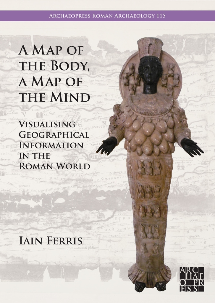
A Map of the Body, a Map of the Mind. Visualising Geographical Knowledge in the Roman World

Author Iain Ferris offers an introduction to his forthcoming book in the Archaeopress Roman Archaeology series.

I remember being flooded with a grief so old
I remember the butcher’s shop on the Viminal Hill

My latest book is about the relationship between geography and power in the ancient Roman world, and most particularly about the visualisation of ideas about geography in the form of ‘geography products’*, at the interface between art and the geo-political environment.
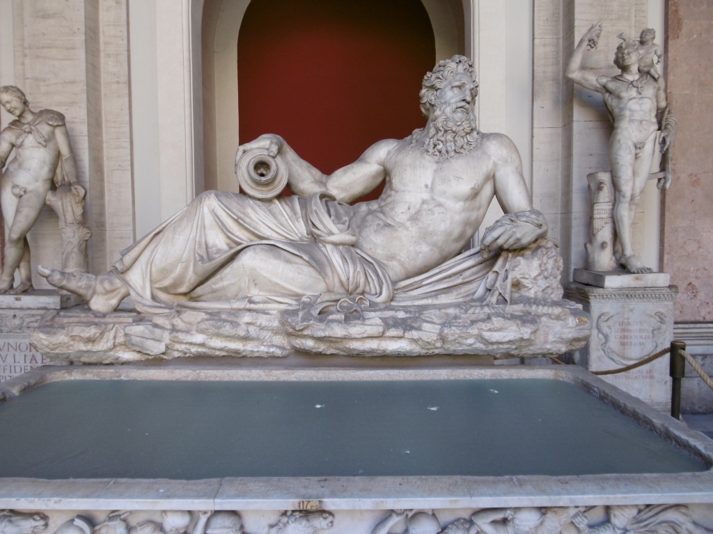
Figure 1. Example of a Roman ‘geography product’. Statue personification of the River Arno. Exact provenance uncertain, probably Rome. Hadrianic. Musei Vaticani, Rome. (Photo: Author).

As Rome broke its political bounds and headed towards empire the whole city became the centre of a larger world and the Roman worldview changed with it. The Roman state then needed to present to the Roman people an easily digestible narrative about its imperial ambitions and its imperial possessions, in a way that went beyond the fact that servitude, enslavement, and misery for many underpinned this expansion. There needed to be a publicly guided discourse centred around the smoothing out of difference, rather than its obliteration or elimination, and the presentation of very different lifeworlds in a familiar way. It marked a way of directing how change could be managed and a way of reimagining how the world might be and might work at the intersection between selection, presentation, knowledge, and insight. Reflection and communication sought then to create a communal sense of belonging.

By intensifying practices that stressed Roman individuality a process of drift was mitigated. Rome after all was not the first power to establish wide Mediterranean networks beyond home territory: indeed far from it. Rome’s external relationships were underpinned by strongly-articulated localised expressions which served to demarcate identity both internally and externally. Local and global practices interacting together played a significant and important role in Rome becoming what might awkwardly be called Mediterraneanised, as had previously and variously happened for others.

The creation of the Roman empire and its expansion almost inevitably led to a recalibration of spatial relationships between Rome and Italy and between Roman Italy and the rest of the known world as it was then. It is true to say that the detail is often in the small print of Roman culture, in its undercurrents. Geographical thinking shaped the forms of contemporary art then, even if only at the level of sub-genres, thus making my study a geography of art but not a study of geography in art, a political geography of the Roman world told through images, a strange spatial ontology layered onto Rome’s fixity in defined physical space. Extraterritoriality such as this can signify openness, freedom, imprisonment, or subjugation. 

When writing the book there was an immediate realisation that the use of the umbrella categorisation of disparate ‘things’ as ‘geography products’ offered a number of potentially critical openings for looking at ancient Rome and its defining of place and space: that a new strand of critical conversation and dialogue could be started. Broadly such products included a slew of visual sources which acted as mnemonic triggers to spatial awareness and the definition can even be extended to encompass tastes, sounds, and smells which might have had the same effect. Written histories, geographic texts, ethnographic studies, poems, epigrams, plays, maps, drawn surveys, and inscriptions could also be geography products. Personifications, bodies and images of bodies could also on occasions be geography products or carry on them such information as to qualify in this respect: land, space, and place literally could be written on the body. I certainly believe that adopting this strategy of definition has allowed narratives, plots, structures, and themes in the evidence to emerge.
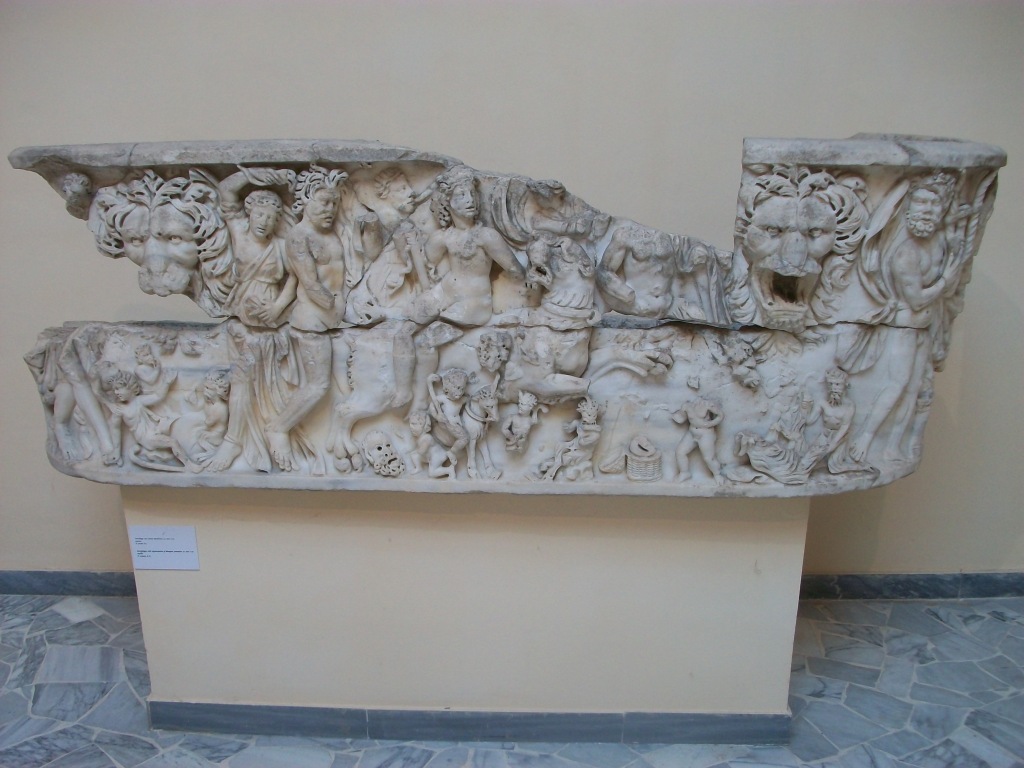
Figure 2. Example of a Roman ‘geography product’. Sarcophagus depicting the Indian triumph of Bacchus, Ostia/Portus. Second to third century AD. Museo Archeologico Ostiense. (Photo: Author).

The history of Roman imperialism to some extent could be described as being a history of fragmentation and a history of exclusion. The city of Rome became a space where an attempt was made to create and present a kind of collective memory. If we can also then talk about moves towards inclusion our discussion has to be tempered with awareness of the constant undertow of cultural dislocation and alienation there. If environments can be said to inhabit us, then Rome became alive with peoples and products of the whole known world: it was not where you were but where you could be, through movement, transformation, becoming. The synaesthetic power involved must have been considerable, with light, music, texts, images, and architecture probably headily combining and proposing many routes through interzones into clear space, as images moved through time and mapped a geography of revelation and resolution. Low-frequency sightings rumbled up like suppressed memories of hauntological places, creating a topography of the human experience mediated by the viewer’s experiences and perspective.  This was as much an exploration of ideas about place, a discourse on desires and the city form, as it was a continuation of architectural traditions. 

Ideas relating to identity, alienation, assimilation, diaspora, and exile could be manifested and presented in the form of images in the Roman world without overt references to geography and origins, and yet inform viewers of just those very things through a mixture of lyricism and dialectics. These images were not simply part of a reflection of a separate or separated world of art: rather they were part of the passionate, rational, and dramatic aspects of everyday life at the time, sparking imaginations that were to be turned on the transformation of reality itself. Viewers were encouraged to discover within themselves desires for other, particular environments and places in order to make them seem real, to regenerate the nature of imagined experience under other skies. The tensions implicit in such strategies are obvious: the city became the total work of art, playing with the presentation of time, space, and place each in turn, then in tandem and combination. The solicitation of the city’s architecture and monuments was seductive and informative to those who were susceptible or open to suggestion. Information gleaned in this way reflected the absence of more practical means to orientate oneself in a changing and expanding world. The study and correlation of accepted snippets of geographical information obtained by cultural osmosis or sought out in a targetted manner on the city’s streets created new and what must sometimes have been very individual and idiosyncratic mental and emotional maps of both the existing cityscape and of distant imagined cities and places. These geographies framed Roman cultural practice. Representational and sometimes direct and sometimes almost abstract, intimate and monumental, systematised and impulsive, together these works did not break the rules of contemporary Roman art but they pushed the boundaries by signing up to all of them. If asked to say what they were about, I would say ‘everything’.

Although occasionally imprecise, these images conveying geographical information often in the form of architectural expression were often highly charged with emotionally evocative power and representing desires, control, events from the past, the present, and the future, rational extensions of religious experiences and myths. Imperial Rome ushered in a period of city planning seen as a means of knowledge exchange. Parts of the city could have corresponded to the feelings usually experienced by chance, but here managed or even manipulated. One could leave the realm of direct experience for that of representation and presentation. The passivity of the old, pre-imperial Rome needed to be reconstituted in some respects by a collective project explicitly concerned with confronting every aspect of the audience’s lived experiences, by drawing attention to the contrast between what contemporary life was actually like and what it could be. Rome could only find its poetry in the present, if informed by the past.

Figure 3. Roma/Tellus, the Ara Pacis Augustae, Rome. 13-9 BC. (Photo: Author).

Roman ideas and concepts about geographic space, about topography, about landscape, about foreign peoples, and about barbarians were developed, one might even say workshopped, in the theatrical sense, through a process of almost trial and error in terms of creating and presenting a coherent series of geography products which utilised words and images to telescope distance and space and to create maps of the body and maps of the mind. The recurrence of these intercalations between political ideology and images was not always simply a repetition of the same thing. There were undoubtedly significant shifts and developments in the way that these encounters were negotiated and whether a meaningful historical trajectory can be discerned in the multiplicity of meanings presented and entangled in the process.

Especially dramatic and portentous was how empowerment with geographic knowledge, when it took place, found expression in new aesthetic practices. Cultural power here was in many ways analogous to economic power. This was not to deny the inherent tension here, that the full pursuit of economic capital was usually incompatible with the full pursuit of cultural capital. Indeed, the process became altogether saturated with aesthetic discourses at the expense of other interpretations. A genealogy of such geographical images was not seeking to provide a continuous history, a seamless narrative, but rather to focus on certain eruptions, breaks, and displacements of the cultural field. It stressed heterogeneities and specificities. Genealogies focused on struggle and competition and were interested less in the narrative of events than in patterns and structures.

Everything in the geographical field must have acted like a citation, embedded discourse, mention rather than use. The false symmetries of good sense reflected techniques of compression and collage, myths of abjection and omnipotence. Homesickness was presented here as a pathology and became a conduit through which a world could emerge. Any attempt to constitute the images as settled carriers of meaning might have run aground on their incompleteness and inconsistency.

In the end almost everything that had directly lived under the Roman system moved into a representation, caught between everywhere and nowhere, geographical images embodying a very particular sensibility and representing a site or locus of deluded aspirations, and yet at the same time probably occasionally freeing the imagination and shackled ambition. All of this emerged in tandem with the defining motifs: consumption, art, the scrambling of linearity, the debasing of perceived truths or grand narratives, the collapse of representation into reality: tensions born of such developments were engaged with and played out in various ways. The ideology lay in its practice, in its ability to pleasure, surprise, transgress, inspire, question and imagine, a mode of critique rather than a definite answer or solution. It confronted, challenged, and gave vent to a message that was both resonant and ambiguous, and it provided a space or spaces to reflect upon or explore the social tensions contained within it. It helped collapse the distinction between here and there and in many ways sought instinct, passion, caprice, and violence. Such images demonstrated a conflict between feelings of being rooted and rootless, belonging and not belonging, place and displacement.

Compassionate scrutiny probably would have revealed the moral complexity of many geographical images, a desire to be fully part of the world mediated by images of oscillation and unsettledness and shadows. Revelation would have helped shatter the sense of continual change, initiating the reuse of images to allow the past to exist in the perennial present. No longer were lost or marginal cultural resources recovered and reimagined: they existed concurrently to be collated, imitated, decontextualised, and disarmed. The differences that had always been contested merged or conflated, and point and purpose hardened as cultural forms evolved away from their initial stimulus. Cultural changes enabled competing sites of attention to operate contemporaneously and probably sometimes competitively too, continuing to provide a means of agency and a platform, even as its cultural traces were archived, appropriated, and often historicised, as was so much of Rome’s cultural output.

A process of critical engagement must have been required on the viewer’s part though, as these images must sometimes have appeared to be contradictory and formative, implicit and explicit, liberatory and reactionary. Meanings were projected but also cultivated from within, shaping the dialogues that ensued as cultural spaces were opened up. The exploration of sexual, psychological, and delinquent extremes was surely a bi-product of the viewing of such images by certain viewers.

Taken together, the collective assemblage of Roman geography products and geographical images were like a series of return journeys which could not be judged on output alone. There was so much more hidden, suggested, left to the imagination. The mystery was left caged. It remained an exception to the rule. Moments of viewing must have helped provide insight into life as a series of potentially random journeys that one might take or might imagine oneself taking, showing some viewers some of the possibilities.

The Romans had many ways to manage geographical information, not only by preparing texts of one sort or another and by literally inscribing themselves on the land of others, and had many scientific ways of handling geographical data. The surveyors’ groma, the cadastral plot, the drawn or inscribed ground-plan of a building, the city plan, the travel itinerary. These were things to help order, understand, and control space and place. But in order to conceptualise geographical knowledge and information art needed to be employed to spark the imagination, to suggest connections, to scare, to bewilder, or even to reassure.
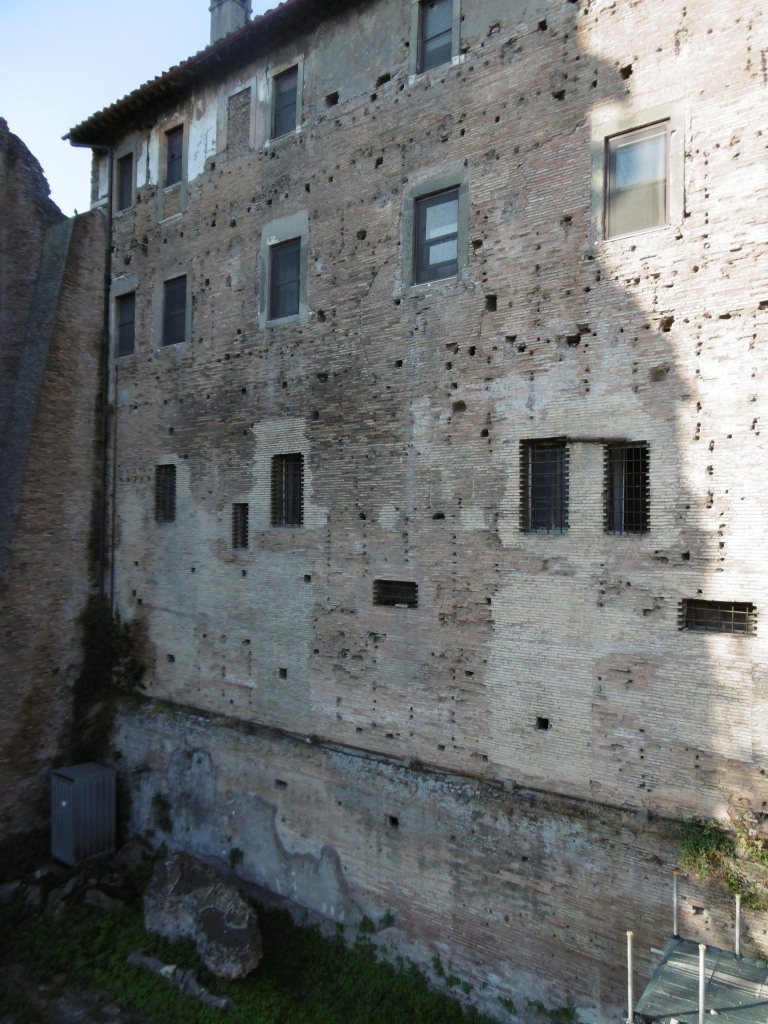
Figure 4. Wall of the Templum Pacis/Temple of Peace, Rome on which the Forma Urbis Romae (Severan Marble Map of the City of Rome) was mounted. Now part of the Church of SS. Cosma e Damiano. (Photo: Author).

These images had purpose, the images were maps of a kind. The great power of illusion, the often unspoken dynamics of society or community, and the excitement and thrill of pursuing empire and expansion all helped shape the people of Rome. The actual and emotional geography of the place in which they lived were intertwined, presented in a way that focused not so much on specific events but rather on subtexts, atmospheres, and perceptions. Though argued in the book not to have been direct, the message was nevertheless clear and present in the architecture of every image discussed and dissected, and in the sounds, the gestures, and the representations on which viewers were asked to turn their attention.

The sociological typology of these images was turned into something more strange and satisfying through the visionary dimension of the scene-setting and by context. The images described distant locations in an exuberant way that foregrounded knowledge and its transmission over experience. They also highlighted and encapsulated rather than denied the ambivalence many people would have felt about their city being part of a larger whole that they themselves had no direct experience of. They were viewing something that aimed to replace their own personal experience with a mediated narrative, hovering between projection and self-recognition, with events happening off stage and in their peripheral vision. This allowed the ordinary citizen with no experience of foreign travel to imagine the power plays behind conquest, violence, and the creation of empire, and to explore those relationships from a place of relative calm and ease. Certain tropes were deployed to a knowing audience, beating familiar pathways, both subverting and not diminishing expectations, creating reciprocity between the viewer and the presenter of the image. Each knew what these signifiers denoted: the process could be recuperative. These circumstantial geographies represented substance, not truth, and tapped in to contemporary desires. This cultural obsession with the idea of place permeated not only Rome’s political and ideological life but its religious life too, certainly up to and including the role of place in the mythology of Christianity, and had its origins in the Roman elite’s over-riding interest in ancestral connections to specific locales.

Rome and its citizens had slipped inexorably from dreams and expectations into an age of greatness, conjuring vivid, concrete images from the quotidian dullness of city life. The complexity and constraint of formal presentation nevertheless was a powerful manifestation of Roman state power, constantly confronting notions of difference and belonging in both a literal and a figurative set of journeys mediated by images.

There is a vast difference between the level and detail of geographical knowledge required to inform political and strategic intelligence decisions and simple background knowledge intended merely to inform those who need to be able to cope with the certainty of uncertainty in a shifting, unpredictable world. The latter was part of a broader suite of strategies required to acclimatise Rome’s citizens and other inhabitants there to the ever-changing nature of what it was to be Roman when the mother city was but a centre rather than simply its own enclosed world. Rome’s success was very much reliant on its ability to integrate and absorb exogenous elements into its host body, be they territories, peoples, cults and religions, and indeed cultural practices. This assimilation was, of course, not without its limits and exceptions, and more often than not achieved by force of arms rather than just by force of will. The spilling of blood could be regenerative for the Roman state in the same way that religious sacrifice underwrote individual piety. Violence was such a deeply entrenched threat in this world that it permeated and infected all human interactions. Trauma was not just an individual event: it was a psychosomatic experience on a social scale. Comparing a society or country to a body made an authoritarian or reactionary ordering of the world seem inevitable, somehow immutable, but the Romans could also liken the body to society, the body to a temple, to a city, to a fortress and so on.

Rather, this self-enclosed aesthetic system elided geography with anthropology, this unity in being of the personal and the social at its peak made sensate in the form of didactic images. But the viewing audience was not a blank canvas: the hyper-politicised urban plebs of Republican and early imperial Rome were anything but, even if their encounters with presented geographic images were intermittent and evanescent. Such images as an assemblage were united more by the myths that they intrinsically connoted and the environment and contexts within which they were framed than by the aesthetic or formal qualities they outwardly displayed. Taken together, it can be suggested that they did not have the specificity and tautness of a true series from which certain aesthetic conclusions or imperatives could be drawn. Rather, they served as a useful coded expression for a whole array of different messages and practices that existed as an extended and multifarious group with partial resemblances and differences, but not sharing any core aesthetic messages that made them one. The series, if considered as a single artistic project, approximated a kind of rapture by setting up a fluid interplay of visual and textual refrains, framing and contextualising existing archival images elsewhere in the city, creating a continuous frame of action and reactivation across the group.

Time and discourse at Rome were not only understood spatially but were mobilised in imaginative ways. The issue at stake was not simply one of iconography. Viewers would have been caught up in the very flux of psychogeography, interiorising the layout of the city, practiced in each of its pivots and sites of junction, digesting every single point of entry and exit. Such navigations would have connected distant moments and far-apart places by absorbing and connecting visual spaces. Narratives would have risen, built, unravelled, and dissipated, revealing potential sites of opening, an elsewhere that was nowhere. An obsession with searching and finding hints of distant lands and peoples would have both revealed and covered a fear of being lost. Presentation of a series might have aimed to corrode the opposition between mobility-immobility, inside-outside, private-public, and dwelling-travel, with architecture in Rome being a map of both dwelling and travelling.

Geographic images seem to have had a mirroring effect, the views of the city of Rome and vistas of foreign lands offered back to the urban audience for viewing. The effect of this must have been cumulative. Whichever path was followed there were different points at which fragments came together narratively. By making tours and detours, turns and returns, the viewer opened up on different vistas of the production of space. Spatio-visual arts created a bond between architecture, travel culture in all its forms, the history of visual art and its well-established tropes, and memory and map-making in its broadest, non-literal, meaning.

What was produced was a mixture of utopias, centred on imperial harmony, and dystopias, relating to conquest and enslavement. The drive to possession and domination created an erotics of knowledge, a spatial curiosity. The geographies of space and the body were combined in this age of exploration and empire. Art is often a powerful way to overcome our limits: limits in both time and space, limits of the mind itself, and limits of perception and capability.

I remember how even the cars in Rome looked ancient
I remember how all that was solid melted into air

* I have adopted the term ‘geography product’ from its use by Katja Pilhuj in her 2019 book Women and Geography On the Early Modern English Stage.

Iain Ferris is an independent academic researcher and a former field archaeologist who has published three archaeological excavation monographs and ten books, the most recent of which, Visions of the Roman North: Art and Identity in Northern Roman Britain, was published by Archaeopress in 2021.


A Map of the Body, a Map of the Mind: Visualising Geographical Knowledge in the Roman World by Iain Ferris

This study considers the relationship between geography and power in the Roman world, most particularly the visualisation of geographical knowledge in myriad forms of geography products: geographical treatises, histories, poems, personifications, landscape representations, images of barbarian peoples, maps, itineraries, and imported foodstuffs.

Forthcoming (Spring/Summer 2024)
ISBN 9781803277813 | Paperback: £45.00
Pre-order at archaeopress.com and save 25%: Use voucher code 781325

Returning to Iraq: new discoveries at Kobeba

St John Simpson, senior curator and archaeologist in the Department of the Middle East at the British Museum, offers a report from Winter excavations in southern Iraq

Kobeba? It is hardly a well-known name in the archaeological literature but is a site which has already produced important discoveries and featured twice on Iraqi state TV. In October 2021 I took a small team to southern Iraq, and returned there in November this year. Kobeba is actually a small cluster of mounds, not far from the town of al-Rifa’i in Dhi Qar governorate, midway between Baghdad and Basra.

Systematic surface survey along transects on Kobeba 1

This is a region filled with sites of all periods, many badly affected by looting in 2003, but still only partly surveyed. There are many teams working in Iraq, including this region, but almost all of these are concerned with the beginnings of urban civilisation and focus on the city sites of the Sumerian and early Babylonian periods. The problem is that these are the exception: the landscape is filled with small and medium-sized sites, these are the ones most at risk from development, and we know almost nothing about them. This applies even more to the so-called ‘late periods’ of the Achaemenid, Seleucid, Parthian and Sasanian periods, and very little attention has been paid to any sites of the Islamic period here either.

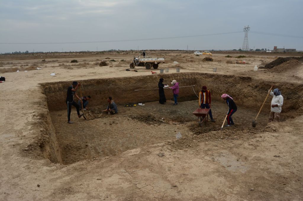
Beginning open area excavations on Kobeba 1

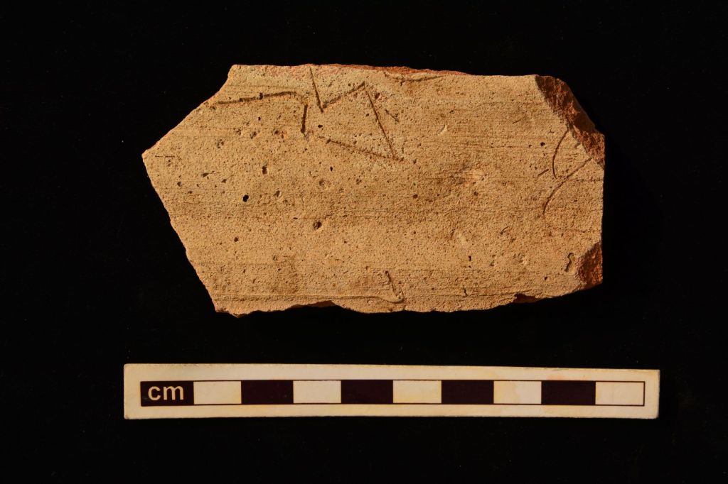
The work at Kobeba is starting to address this imbalance and has produced some wonderful discoveries. It was first occupied at the beginning of the third millennium BC, a key transitional moment at the inception of urbanism and writing. This is known as the Jemdet Nasr period but much remains to be understood about it. During this period Kobeba was producing pottery, and among the debris in the potters’ quarter were purpose-made tools for scraping the insides of jars before they fired, the base of a solid-footed goblet with the accidental impression of the cord used to cut it off the hump as it was thrown on a wheel, and the remains of another which had been discarded before firing. The lower part of a gypsum vessel carved in low relief shows part of a reclining animal and belongs to a style of carved stone vessels typical of this period but hitherto known exclusively from the city-sites of Ur and Uruk to the south. The fragment of a pottery jar carefully incised after firing carries part of a pictographic inscription, preceding the later development of cuneiform. These two finds prove that literacy and the minor arts were not confined to the urban elites even at this early date.

Ceramic ring scraper and the scraping marks on the interior of a pottery jar
Pottery from the Jemdet Nasr period
Potsherd with part of a pictographic inscription of the Jemdet Nasr period

Kobeba was occupied and abandoned at intervals through the millennia which followed, a much more typical and dynamic pattern of settlement than the continuous occupation of the cities. A fragment of a polished calcite vessel found on the survey attests an import from eastern Iran: found in large numbers in the ‘Royal Cemetery’ at Ur, such luxuries have not been recognised at small sites, and it gives another hint of the unintentional bias affecting our understanding of the circulation of such goods.

The site was finally occupied in the Sasanian and early Islamic periods. The excavations have produced one of the few sequences from these periods, with a large assemblage of stratified pottery which already challenges the traditional dating of some of the most recognisable types used as ‘type fossils’ on archaeological surveys. Glazed wasters indicate that pottery continued to be made here during the Sasanian period. There is also a large amount of glass from the latest period, mostly open bowls and small plain bottles. This occupation dates to the eighth century and it was then that a small mudbrick mosque was built in an open area between rows of houses connected by narrow alleys and passages. The mosque was simple, unadorned, with a mihrab and a single door, and housing no more than 22 worshippers at once. This is a rare chance to see Islam in the local community, far from the big congregational mosques of the cities like Kufa or Wasit, yet an equally tangible expression of the need to build a dedicated place of prayer.

Trench 8: tannur and other features contemporary with a post-Sasanian structure (left) with the latest early Islamic level being excavated at the top

During this latest period, Kobeba continued its role as a centre of production, doubtless supplying smaller villages in the surrounding countryside. However, the core activity now was not pottery but grinding stones made by firing blocks of clay at up to 1200 degrees C, and then chipping and flaking away the corners and tops into the required circular shape, leaving great chunks of useless debitage discarded close by. This industry has a long history in Iraq, beginning at least by the early second millennium BC, when this so-called ‘synthetic basalt’ served as a hard-wearing local substitute for imported stone. Producing these must have required huge amounts of fuel, doubtless bushes or reeds gathered from all around, and also great care and skill to work the blanks into their final form. Fragments of such grinding stones are found at all of the Sasanian and early Islamic sites that I have visited in this region, but their production limited to a smaller number of places like Kobeba.

But why was Kobeba finally abandoned? Complete objects, including a copper alloy ladle, seals, coins and a cosmetic mortar, were found lying on the floors, suggesting that this may have been quite a rapid process. The result of civil war? Or disease? Either is historically possible, but there is a third possibility that also chimes with the present, namely lack of water. In hot regions such as southern Iraq, permanent occupation is completely reliant on the availability of fresh water for agriculture as well as drinking and washing. There is a massive water crisis in Iraq today as its upstream neighbours divert rivers into dams and irrigation schemes of their own, once fertile areas are abandoned, and processes of desertification are already underway in marginal areas.

Copper alloy dipper ladle in situ
Re-enactment of men at prayer in the excavated mosque

The forthcoming analyses of the plant and zooarchaeological remains will undoubtedly shed light on the food economy of Kobeba. The survival of pollen in core samples also offers a possibility for creating a detailed environmental reconstruction for the site. This is particularly exciting as geoarchaeological sections dug near the site show big changes in the soil sequences, with palaeo-marsh deposits contemporary with the latest period at Kobeba being replaced by dry clay. The effects of climate change are all around us today but it looks as if Kobeba may have suffered from environmental changes even earlier.

There is much to be done on the analysis of the results from Kobeba, but they offer new insights into everyday life in a Mesopotamian market town from the beginning of writing to the transition from Late Antiquity to the early medieval period.

Excavations and recording in progress of a refuse layer in ancient marshes surrounding the site; the low mound of Kobeba is in the background

Archaeopress books by the author include:

Sasanian Archaeology: Settlements, Environment and Material Culture (2022)

Masters of the Steppe: The Impact of the Scythians and Later Nomad Societies of Eurasia (2021)

Softstone: Approaches to the study of chlorite and calcite vessels in the Middle East and Central Asia from prehistory to the present (2018)


Sincerest thanks to Dr Simpson for providing this blog post. His latest book published in December 2022 and is available now in paperback and PDF eBook formats: Sasanian Archaeology: Settlements, Environment and Material Culture

Paperback: £75.00

PDF eBook: from £16.00

Download free sample PDF

An Educator’s Handbook For Teaching About the Ancient World

Dr Pinar Durgun discusses the context and background behind her innovative new handbook presenting ‘recipes’ for teaching about the ancient world.

How did the book come about?

The world has changed so quickly and so drastically around us in 2020. So has our teaching: online and open-access resources have often been the only way students and educators can access and share information, when libraries, schools, and cultural organizations have been closed for much of the year, and in many cases remain so. Even when they have re-opened, educators have been forced to teach in entirely new or hybrid formats.

Teachers (inspired by ancient Assyrian, Mayan, and Greek depictions holding teaching tools)  and students (holding various school supplies) in a classroom. The image imitates the style of painted ancient stone reliefs. The colors and details are worn. Cover artwork by Hannah M. Herrick.

Now that many of us are required to teach over digital platforms, can we expect our students to listen to us lecture for two hours and give us their undivided attention? The instructional designers I work with in preparing my online courses suggest that online lectures should be 10 minutes maximum. So do many other educators. This is how long your students can focus on your lecturing voice and your ‘floating head talking’ video. In the physical classroom, the maximum is around 15-20 minutes. So how do we communicate information and teach content for longer stretches of time while still enabling students to interact and engage?

Interactive classroom activities make learning undeniably more engaging and fun, in addition to providing students with physical dexterity, collaboration, critical-thinking, problem-solving, and analytical skills. There are very creative educators among us who have been teaching about the ancient world in exciting ways using hands-on, project-based, and experiential activities. I wanted to use these activities in my classes. And based on dozens of activity exchanges with my educator friends, I was sure that other educators were also looking for new strategies to engage their students with the ancient world. This is why I created An Educator’s Handbook for Teaching About the Ancient World.

‘Live like it’s 3000 BC: Experimental Archaeology; students are flintknapping to produce an Acheulean hand axe. Brown University, 2018.

What is in the book?

The initial idea was to format the lesson plans into a cookbook, with teaching ‘recipes’, which include the materials, budget, preparation time, and level of students so that any educator could replicate these recipes in their classes. Some of these activities require materials, some do not. Some need to be prepared before class, some require no preparation. Some of the activities are very much tied to the culture, time period, or place, but some can be applied to any content. Some of the activities were written by a single educator, and some are a product of collaborative teaching. All of the activities, however, are tested in the classroom and peer-reviewed by other educators. More importantly, all activities are engaging, hands-on, immersive, and/or experiential. They are only a small portion of the endless possibilities of making teaching and learning about the ancient world fun, meaningful, and informative.

An example of the ‘recipe’ format: ‘Making Lions at Babylon’ by Anastasia Amrhein and Elizabeth Knott

In addition to these teaching recipes, this book also addresses some important issues in ancient world pedagogy: Why should we publish educational resources as open access? How can we effectively make use of museums and ancient objects in our teaching? Why should our research and pedagogy be collaborative? Our teaching has broader implications. These essays address such implications and provide great examples and case studies for educators to apply these methods and ways of thinking to their own teaching. I hope this book will be a resource where we can learn from each other about ancient world pedagogy regardless of the time periods, cultural or geographical areas, and subjects we teach.

Who is this book for?

Educators teaching about the ancient world. Students and parents learning how to teach about ancient world. Anyone who is interested in the ancient world and pedagogy. The activities in this book can be implemented online or in-person, in school, university, library, museum, or home classrooms. Every activity specifies the age/grade level of students for which the activity is appropriate. Many activities also have optional steps to make the activity work for other ages/levels. The activities and essays were written by school teachers, university instructors, and museum educators who teach about ancient objects, materials, peoples, and cultures.

Some of the activities were also written in different languages. Contributors and educators Leticia Rovira and Cecilia Molla from Argentina, who wrote their activity both in English and Spanish, say that this book is:

“a novel contribution to the didactics of ancient societies’ teaching. The main objective is challenging and enthralling: to go beyond the thresholds of academy and reach another very important audience –students at different levels- and try to capture their interest, drawing their attention towards our fields of study through a wide diversity of appealing didactic proposals.”

You can find out more about the Contributors here: https://pinardurgunpd.wixsite.com/teachancient

One of the goals of this book was to open up the conversation about ancient world pedagogy and create a hub for more collaboration. I encourage you to try out the teaching activities and share your photos and observations with other educators: https://pinardurgunpd.wixsite.com/teachancient/gallery 

You can also explore further pedagogical resources about ancient world pedagogy here: https://pinardurgunpd.wixsite.com/teachancient/copy-of-about

About the Author

Dr Pınar Durgun is an art historically-trained archaeologist with a background in anthropology, cultural heritage, and museums, passionate about outreach and education. She received her Ph.D. from Brown University and has been teaching for about a decade in universities, museums, and school classrooms about archaeology and the ancient world. As a dedicated public scholar and educator, Dr Durgun hopes to make academic information about the ancient world accessible, fun, and inclusive. Find out more about her work here: https://pinardurgunpd.wixsite.com/pinardurgun

Grab it and spread the word!

The eBook version of my book is FREE to download in Open Access. To download the free eBook or to purchase a printed hardback copy, please click on the cover image below:

Sincerest thanks to Dr Durgun for writing this article for the Archaeopress Blog. To submit an article, please send your proposal to Patrick Harris: patrick@archaeopress.com

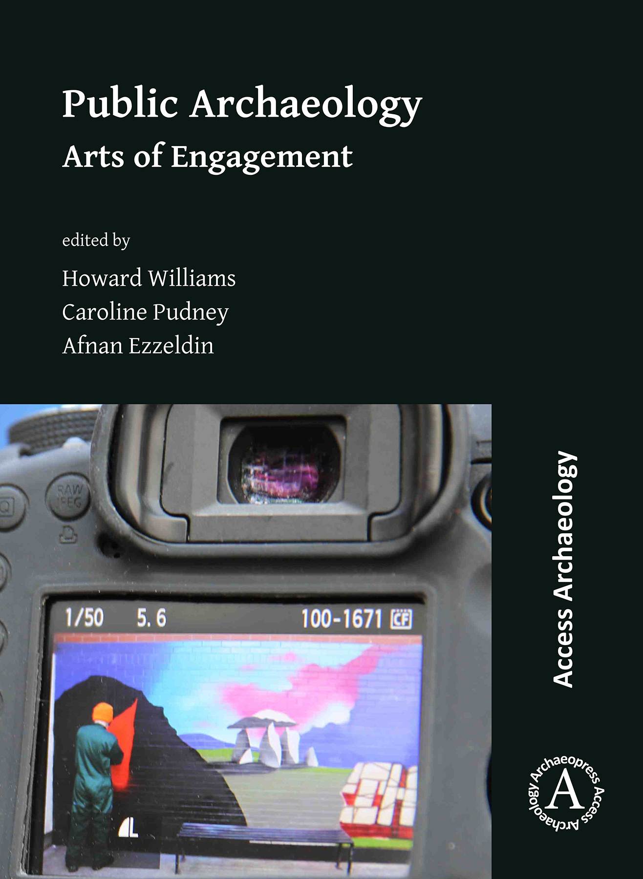
Public Archaeology: Arts of Engagement

Professor Howard Williams, University of Chester, introduces his co-edited volume stemming from the 2nd University of Chester Archaeology Student Conference, April 2017.

How should communities be engaged with archaeological research and how are new projects targeting distinctive groups and deploying innovative methods and media? In particular, how are art/archaeological interactions key to public archaeology today?

9781789693737We proudly present the brand-new book: Public Archaeology: Arts of Engagement, appearing in the fabulous Archaeopress Access Archaeology series.

There remain surprisingly few edited collections in the field of public archaeology. Building on recent work, including the edited collection from 2015 Archaeology for All:  Community Archaeology in the Early 21st Century edited by Mike Nevell and Norman Redhead, and Gabriel Moshenska’s edited collection: Key Concepts in Public Archaeology, this new book helps to extend and expand critical discussions. It provides an outlet for an original and distinctive mix of fresh perspectives and approaches, specifically addressing art/archaeological intersections in public archaeology’s theory and practice. Our book focuses on UK perspectives and practices in public archaeology, although we feel many of the themes addressed are of global significance.

How did it come about?

poster2Following the 2nd University of Chester Archaeology Student Conference, 5 April 2017, Dr Caroline Pudney and I teamed up with former student Afnan Ezzedin to take the research presented forward to publication. We have crafted a proceedings which combines distinctive and select contributions from (undergraduate and Masters) archaeology students together with a range of original investigations and evaluations from academics and heritage practitioners.

For me, this has taken a huge amount of time, energy and personal sacrifices to get this done over the last 31 months or so. I’d also like to point out that this is part of a series of edited collections stemming from the Grosvenor Museum student conferences. I’ve now produced 2 of the 5 student conference volumes I’ve committed myself to. The first – The Public Archaeology of Death was out in January 2019. The third – Digging into the Dark Ages: Early Medieval Public Archaeologies – will be out in early 2020. The fourth is in production: The Public Archaeology of Frontiers and Borderlands.

What’s inside?

There are 22 contributions all told by 26 authors; many chapters are supported by colour illustrations.

Sara Perry writes an insightful and personal Foreword, using her own experiences as a means on reflecting about how we write critical public archaeologies which take our practices in new directions. Following this, there are two chapters by me. The first is an introduction which surveys pertinent themes and issues in public archaeology and art/archaeology interactions in particular, and the second, written to showcase the student presentations incorporated into the book as well as those that were not, reviews the conference and the development of the book.

The main body of the book is split into 3 sections. ‘The Art of Engagement: Strategies and Debates in Public Archaeology’ contains 8 chapters exploring different ways in which strategies are being deployed in public engagement and how we evaluate our practices. For example, I have co-authored a chapter in here which draws on the conference paper and essay by Rachel Alexander; we evaluate the much-lauded Operation Nightingale’s dialogues with early medieval warriors.

The second section – ‘Arts in Public Archaeology: Digital and Visual Media’, incorporates 6 chapters, each exploring different means of public engagement and evaluating their potential and challenges. My chapter in this section, for example, critically reviews my Archaeodeath blog from its inception in 2013 to the end of 2018.

The third and final section – ‘Art as Public Archaeology’ – has 4 chapters, considering different visual media as subject and strategy for public and community projects.

The Afterword by Dr Seren Griffiths identifies that all archaeology should have a ‘public’ dimension, and that creativity and playfulness must be key ingredients of good public archaeology.

Tell your friends, colleagues and libraries…

Afnan, Caroline and I hope you enjoy the book and appreciate its availability via open access as well as to acquire in print. The book is available now via the Archaeopress website, available to buy as a hard copy or download as a pdf free of charge.

Click here for a flyer offering 20% off a printed copy.

Libraries at least should definitely have physical copies to complement the online ones I think! Also, in case you weren’t sure, archaeology books as Christmas presents are definitely a thing!

Acknowledgements

educate-north-awards-2019-winner-badgeI duly acknowledge the hard work of the students and colleagues in facilitating the conference. I also recognise the help and camaraderie of my co-editors Caroline and Afnan, the enthusiasm and contributions of the authors, the generous guidance of so many of my fellow archaeologists, the critical insights of the peer-reviewers, and the steadfast support of Archaeopress. Together this team has shown commitment in creating a high-quality peer-reviewed academic publication with no funding and sparse other support. I’m therefore very proud that these conferences and their publications are recognised as a positive thing: it was great to receive the 2019 Educate North Teaching Excellence Award as a result.

The book is dedicated to the memory of Dr Peter Boughton FSA, Keeper of Art for West Cheshire Museums who had worked hard to facilitate the conferences taking place at Grosvenor Museum as public free day conferences in the heart of the city of Chester.

Header photo: The Heritage Graffiti Project during creation. Photograph: Ryan Eddleston.

Sincerest thanks to Howard for providing this article for the Archaeopress Blog. Public Archaeology: Arts of Engagement is available now in print (£58) or as a free pdf download.

20191031_150717
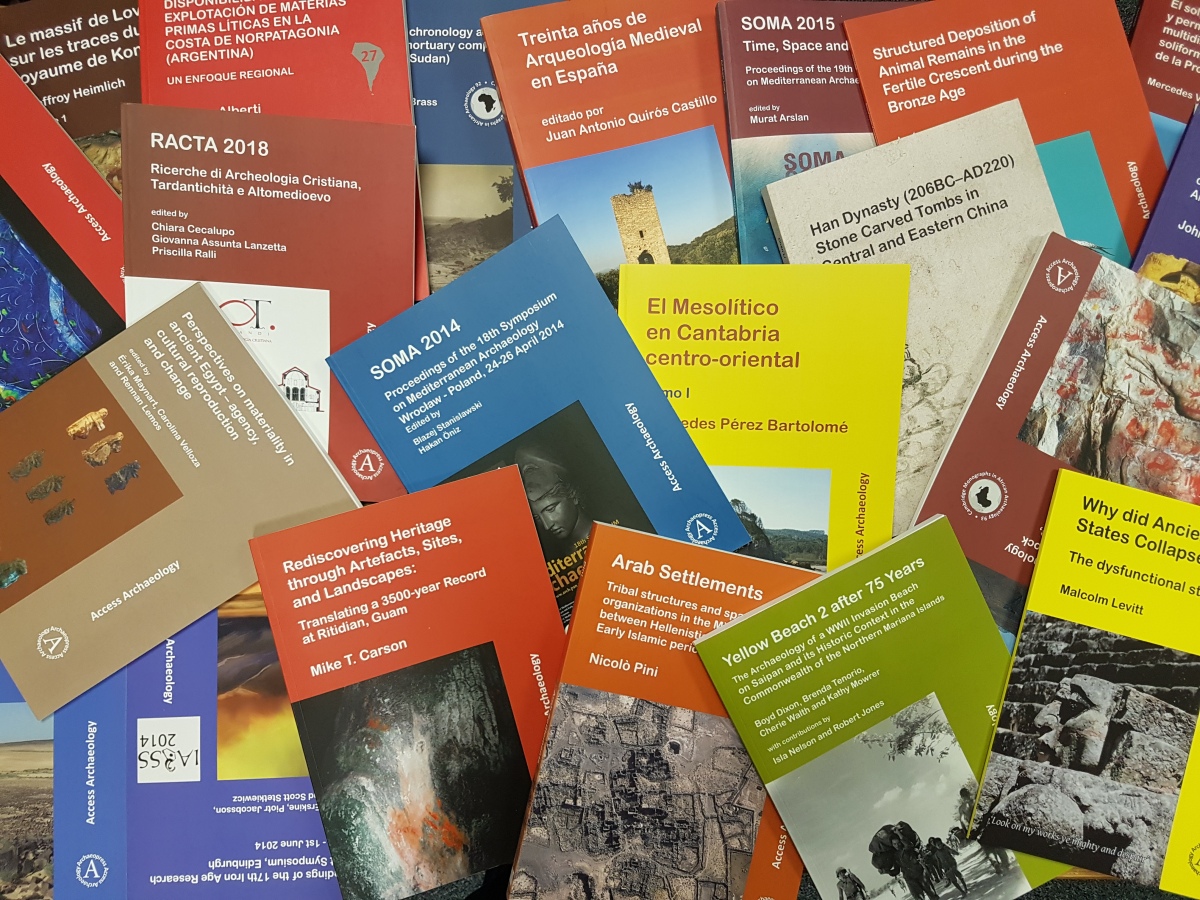
A selection of Access Archaeology titles published since 2015.

Learn more about Archaeopress Access Archaeology in our recent article celebrating 100 titles in the range.

Access Archaeology: A New Approach to Archaeological Publishing

November will see the 100th title released in the Archaeopress Access Archaeology imprint where all titles are available as free-to-download pdf eBooks or in printed paperback.

Here at Archaeopress we are fond of what we call a ‘bath idea’. In 2014 it was a bath idea that led to our first experiments with Open Access publishing, and in 2015 we began to conceive of a new publication model – a side-line to our more regular publishing endeavours – designed to function outside the parameters of the accepted wisdom of academic publishing.

Archaeopress is owned and run by archaeologists, and this has always influenced our perspective on what constitutes a useful publication. We receive many proposals that, following traditional publishing models, would not be commercially viable. But that is not to say they are not academically valuable, containing unique data, rare catalogues, intriguing synthetic analysis etc.

Access Archaeology evolved as a model to support many types of archaeological publication including PhD dissertations, smaller conferences and symposia, research projects, and commercial archaeology from parts of the world where funding is limited. It also supports publications that fall between conventional models: too long perhaps for a journal article, but too short for a traditional monograph.

All Access Archaeology titles are available as free-to-download pdf eBooks and in print format. The free pdf download model supports dissemination in areas of the world where budgets are more severely limited, and also allows individual academics to access the material privately, rather than relying on a university or public library. Print copies, nevertheless, remain available to individuals and institutions who need or prefer them.

9781789692587Dr Boyd Dixon, Senior Archaeologist for the Cardno GS office in Guam and the Commonwealth of Northern Mariana Islands (retired), explains how the model afforded greater outreach in the local area:

‘Our recent volumes about Yellow Beach 2 and Afetna Point have found a receptive audience in the public, and in secondary school and community college on Saipan.

I feel it is the caliber of Archaeopress publications and photographs and maps, with their open access to a broader public that makes [the] volumes of particular interest.’

governors-humanities-awards
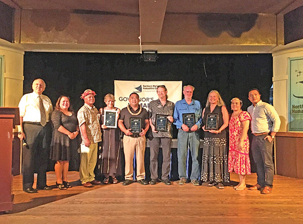
Boyd Dixon (fourth from right) was awarded a Lifetime Achievement Award by the CNMI Humanities Council in October 2019, citing his two Access Archaeology publications among other endeavours of similar archaeological and historical interest.

9781789693737By asking authors and editors to take a greater role in the production process and by making use of the huge improvements seen in recent years in print-on-demand technology, the books are typically made available in print and online formats, including the free download option, at no cost to the author/editor. Howard Williams, Professor of Archaeology at the University of Chester and co-editor of two forthcoming Access Archaeology titles, Public Archaeology: Arts of Engagement (due November 2019) and Digging into the Dark Ages, explains:

‘I’m a relatively experienced academic editor (having edited the Royal Archaeological Institute’s Archaeological Journal for 6 volumes over 5 years, and edited/co-edited special issues of the journals Anglo-Saxon Studies in Archaeology and History, Early Medieval Europe, Mortality and European Journal of Archaeology.) In this context, I was happy I could maintain high academic standards and take on editing and typesetting supported by the friendly and helpful Archaeopress team. Access Archaeology allows the latest research to be published as both print-on-demand and open-access online without a cost to the contributors. This was especially important for me given the books develop from student conferences and include a mix of student pieces with those by more established heritage professionals and academics.’

9781789691726Gina L. Barnes, Professor Emeritus at Durham University and co-editor of the 2019 publication TephroArchaeology in the North Pacific, notes the free download and on-demand model offers considerable flexibility regarding colour content and page count:

‘The format allowed for considerable freedom in presenting the material, without word limits or restrictions on illustrations; colour pictures were possible for both the digital and print versions… I have been very pleased with the process throughout, through encouragement by David Davison in commissioning the work, communication with the team about formatting problems, assistance in the peer review process, and getting the document out in a timely manner…’

9781789691924Dr Mark McKerracher, postdoctoral researcher on the FeedSax project at Oxford University, explains that the range provides an ideal home for manuscripts originating from data-heavy PhD dissertations such as his 2019 publication, Anglo-Saxon Crops and Weeds: A Case Study in Quantitative Archaeobotany:

‘I found Access Archaeology to be the ideal publisher for the specialist, data-heavy manuscript I had prepared from my doctoral thesis. The editorial staff were very helpful and enthusiastic, and the production process was impressively fast once I had submitted my text according to the formatting instructions. Within two or three months, an open-access PDF and a high-quality paperback, including colour illustrations, were both available. I’d recommend Access Archaeology to anyone looking for an efficient way to publish specialist, data-driven monographs.’

9781789693751Dr Loretta Kilroe, Project Curator: Sudan and Nubia at the British Museum, organised the conference Invisible Archaeologies: Hidden aspects of daily life in ancient Egypt and Nubia held in Oxford, 2017. Dr Kilroe considers how the Access Archaeology model affected the decision to publish the proceedings:

‘So many people encouraged us to publish a Proceedings volume after our Invisible Archaeologies conference, but I wasn’t really sure how to go about it. Archaeopress were super helpful and their Access Archaeology range meant that it wasn’t out of reach, even for an impoverished student conference. Traditional publishing is often so slow and restrictive, and it is fantastic that our authors will have digital access to their own work immediately!’

Delegates
Early career academics at the Invisible Archaeologies: Hidden aspects of daily life in ancient Egypt and Nubia held in Oxford, 2017.

With the imminent arrival of both Prof. Williams and Dr Kilroe’s edited volumes, we will soon have published 100 titles in the range since 2015 with subjects as diverse as metallurgy in Bronze Age Eurasia, Etruscan domestic architecture, digital imaging of artefacts, public engagement with heritage, volcanic archaeology, symposia for early career Egyptologists, and far more.

Long-running series that have found a happy home within the range include Cambridge Monographs in African Archaeology, Paris Monographs in American Archaeology, and the South American Archaeology Series.

We are very proud of how the Access Archaeology imprint has developed from a bath idea to a thriving publishing model. We hope it offers a unique path to publication within the academic publishing landscape for research that might otherwise struggle to find a wider audience. The range may well continue to evolve over time, but its ambition will always remain to publish archaeological material that would prove commercially unviable in traditional publishing models, without passing the expense on to academics, be they author or reader.

Publish in Access Archaeology

If you have a proposal you think fits within the scope of the range we would be very pleased to hear from you; simply complete our brief submission form and send by email to Archaeopress editor Dr David Davison: info@archaeopress.com.

Download / Buy Access Archaeology Publications

See the full list of Access Archaeology publications on our website, all available as free PDF downloads or to purchase in paperback editions.

Patrick Harris
Archaeopress

Contact: E-mail | LinkedIn | Facebook | Twitter

The Value of Simulated Heritage in China

By Cornelius Holtorf, Linnaeus University, Kalmar, Sweden; Qingkai Ma, Zhejiang University, Hangzhou, China; Xian Chen, Zhejiang A&F University, Hangzhou, China; Yu Zhang, Zhejiang A&F University, Hangzhou, China.

Commercially driven copies are conventionally considered to lack relevance to heritage because they are of recent origin and lack heritage values. But for others, including us, heritage should be valued in relation, not to its origin, but to its function in society. In the past, research on cultural heritage has centered on material things which can be catalogued, listed, conserved. In the last decade, heritage has been redefined as an area that is concerned primarily with people. Heritage is now theorized as a range of cultural practices in which people invest meanings to things and ascribe values to them (Smith, 2006; Filippucci, 2009). Heritage is a process which creates new meanings and values, and the cultural meanings of heritage are validated through linkage to the past (Smith 2006). To date, research on the interactions of people, material things and relevant cultural processes is frustratingly scarce (Wells 2015).

Fig 1 IMG_3239
Figure 1. Geometrical perfection: view along the “Champs Elysees Shopping Street” towards the 1:3 scale-Eiffel Tower in Tianducheng, a suburb of Hangzhou, China. Photograph: Cornelius Holtorf 2018.

These issues can be illuminated further by the case of Tianducheng (Sky City), a simulated heritage site in Hangzhou, China. The city is a large suburb, which is designed to incorporate a selection of very prominent architectural heritage features from France including a 1:3 scale but nevertheless imposing copy of the Eiffel Tower in Paris (fig. 1). It is one of many suburbs in China that resemble far-away places and include copies of foreign historical landmarks, reflecting Chinese imaginations of the Western lifestyle (Boskar 2013, Piazzoni 2018). These suburbs are commodities that originated in a specific economic and cultural framework of contemporary China. As such, Tianducheng is part of the cultural heritage of early 21st century China. But questions are also raised about the relationship to the original heritage sites in France which Tianducheng evokes.

Arguably, more important than age is the experience of pastness which has been defined by Holtorf as the quality for a given object to be ‘of the past’. The presence of pastness is not related to age but specific to a particular perception situated in a given social and cultural context (Holtorf 2017a: 500). The Eiffel Tower in Hangzhou may not fool anybody about its recent age. But it plays on pastness insofar as it matches exactly people’s expectations of French 19th century architecture and the history that connects that architecture with the present-day city of Paris. We can therefore, in this case, speak of simulated heritage. It simulates the pastness of Paris’ heritage in another city, Hangzhou in China. We suggest that a strict distinction between simulated and non-simulated cultural heritage is not particularly helpful in any attempt at understanding either; instead we should be looking at what they share with each other (see also Holtorf 2017b).

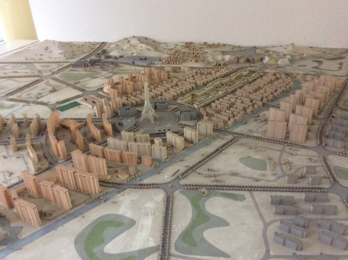
Tianducheng was initiated by the real-estate company Guangsha Group which started this enormous project in 2001. It was a pioneering project back then, for this corporation wanted to build a self-sustained satellite city around Hangzhou and contended to lead the urbanization process in China. On the webpage of this property, it advertises itself as “taking France culture as its city culture” while “setting ‘business, tourism, residency and education’ as its pillar industry in this city” (http://www.guangsha.com/index.php/newsinfor/23/3682). The Eiffel Tower and the nearby park were finished before the apartment buildings were sold. They present a clear image of French culture to attract people to buy properties and settle down in Tianducheng (figure 2).

Fig 2 IMG_3198
Figure 2. Alternative Paris: model of Tianducheng in Hangzhou, China, as envisaged by Guangsha Group, the real-estate developer of the area. Photograph: Cornelius Holtorf 2018.

Interestingly, the construction of both the original and the Chinese Eiffel Towers were hotly debated. Opened in 1889, the French tower was widely criticized by the cultural elite at the time but became a huge popular success. Intended to be dismantled after 20 years, the 324m tall tower became a valuable asset for the city and has not only been maintained until the present day but also copied several times at other locations in the world (Wikipedia n.d.). Built in 2007, the 108m tall Chinese Eiffel Tower went through a similar controversy. On 20 November 2010, Guangsha Group started to dismantle the tower without notice, which caused a backlash among residents (Chen 2010). Many residents called the media to report what was going on and hung protest banners on the tower. After negotiation, the company decided to cease dismantling and returned the tower to its original condition.

Arguably, Tianducheng fulfills some of the same functions of heritage in Hangzhou as the original sites fulfill in France, in relation to place-making, for example. According to Laurajane Smith (2006: 79), place is “not only a space where meaningful experiences occur, but is also where meanings are contested and negotiated.” Indeed, place “provides a profound centre of human existence to which people have deep emotional and psychological ties and is part of the complex processes through which individuals and groups define themselves” (Convery et al. 2012, p. 1). People’s sources of meaning and experience as well as their environments all contribute to place-making (Harvey 2001). In the case of Tianducheng, as of course with the French original, local residents construct their sense of place from the iconic tower, its magnificent view during daytime and the light show on display at night, as well as from various leisurely activities around the tower. At daytime, it is relatively quiet. When the night curtain falls, it is lively, and can indeed be difficult to find parking spaces. Many people come here to enjoy square dancing with friends, to visit restaurants, and enjoy the tower light show. What is most important is not the question of whether or not the architecture has been copied, but how each site contributes to the local residents’ lives and their sense of place.

We spoke to some of the local population living in Tianducheng. More and more people choose to settle there, and the majority of them seem to enjoy the place very much. A shopper we spoke with stated that “of course we know we are not in Paris, everybody knows that. But we still enjoy the view and relaxing atmosphere.” On a web forum of local residents, many others expressed their appreciation of the site, too. There are also visitors going there, taking photos to “pretend” that they are in Paris and subsequently posting them on WeChat moments (similar to Twitter). This applies in particular to wedding pictures. The tower serves as a widely known symbol and icon. When people want to meet somewhere or when they want to locate a certain place, they tend to use the tower as a reference point. One of our interviewees is a member of the local Yixing jogging group. Among other activities, the group meets every morning underneath the tower to start a jog around the city. Ma Gangwei, the interviewee, said, “I like it here. But I don’t have any particular thoughts about this France thing. …I’ve never been to France. I don’t know what it is like to live in Paris. But I like the surroundings here. It might not have much to do with the architectural style. It’s about the park, the mountain, the environment here.”

Fig 3 P1180896
Figure 3. Hybrid cultures: “Champs Elysees Noddle Restaurant” serving Chinese food along the “Champs Elysees Shopping Street” in the France-inspired city of Tianducheng in Hangzhou, China. Photograph: Cornelius Holtorf 2018.

Tianducheng is both French and Chinese. Some of the shops in the associated commercial district express an emerging hybrid heritage. One restaurant is called “Champs Elysees Noodle Restaurant”, but it serves local food, a kind of noodles from a city in the Zhejaing province (figure 3). Whereas the simulated Eiffel Tower may represent the power of cultural globalization, the local businesses and their customers appropriate the attractiveness of the iconic structure to enhance the practice of their own traditions. In that sense, we may see in Tianducheng a case where “global forces create conditions for local traditions to survive” (Reisinger 2013: 41). Somewhat ironically but hardly surprising, there are likely some Chinese restaurants in walking distance from the French tower, too. Many seemingly clear distinctions between the French and the Chinese versions of “Paris” and the “Eiffel Tower” thus fade away on closer inspection. What emerges is a common heritage value of the Eiffel Tower materialized on opposite sides of our planet in hybrid forms.

Places like Tianducheng simulate heritage, but at the same time they provide real heritage value in society and should therefore not be dismissed. In cases such as this, we may see some glimpses of a future of heritage that contradicts and replaces familiar concepts of cultural heritage bound to place and time. Tianducheng challenges us to think carefully about the possible character of future pasts and their benefits in society (Holtorf 2017b). It raises some profound questions: will there soon be many more suburbs around the world that simulate the past of other places? Should heritage experts and historians welcome them in the same manner as local communities do, appreciating their qualities? Does China lead the way towards the future of the past?

References

Boskar, Bianca (2013) Original Copies. Architectural Mimicry in Contemporary China. Hongkong: University of Hongkong Press and Honolulu: University of Hawai’i Press.

Chen, Xiang (2010) The landmark of Tiandu city is gone. Morning Express.November 22nd, 2010, A0003

Convery, I., Corsane, G., & Davis, P. (Eds.). (2014). Introduction: Making Sense of Place. In Convery, I., Corsane, G., & Davis, P. (Eds.). Making sense of place: Multidisciplinary perspectives. Woodbridge: The Boydell Press.

Filippucci, P (2009) Heritage and Methodology: A view from social anthropology. In Sørensen, M. L. S., & Carman, J. (Eds.). Heritage studies: Methods and approaches. London and New York: Routledge.

Harvey, Penelope. (2001) Landscape and Commerce: Creating Contexts for the Exercise of Power. In Bender, Barbara, Winter, Margot. (Eds). Contested Landscapes: Movement, Exile and Place. Oxford: Berg.

Holtorf, Cornelius (2017a) Perceiving the Past: From Age Value to Pastness. International Journal of Cultural Property 24 (4), 497-515.

Holtorf, Cornelius (2017b) “Changing Concepts of Temporality in Cultural Heritage and Themed Environments.” In: F. Carlà-Uhink, F. Freitag, S. Mittermeier and A. Schwarz (eds) Time and Temporality in Theme Parks, pp. 115-130. Hannover: Wehrhahn.

Piazzoni, Maria Francesca (2018) The Real Fake. Authenticity and the Production of Space. New York: Fordham.

Reisinger, Yvette (2013) Reflections on globalisation and cultural tourism. In: M. Smith and G. Richards (eds) The Routledge Handbook of Cultural Tourism, pp. 40-46. London and New York Routledge.

Smith, Laurajane (2006) Uses of Heritage. London and New York: Routledge.

Wells, Jeremy C. (2015). Making a Case for Historic Place Conservation Based on People’s Values. Forum Journal, 29 (3), 44-62.

Wikipedia (n.d.) Eiffel Tower. https://en.wikipedia.org/wiki/Eiffel_Tower (accessed 18 Nov 2018)

9781784915001Sincerest thanks to Cornelius Holtorf, Qingkai Ma, Xian Chen, and Yu Zhang for providing this article for the Archaeopress Blog.

Further reading available from Archaeopress:

The Archaeology of Time Travel: Experiencing the Past in the 21st Century edited by Bodil Petersson and Cornelius Holtorf

Paperback ISBN 9781784915001 (£38)
eBook available as a FREE download: Download here.

holtorf search the past

Search the Past – Find the Present: Qualities of archaeology and heritage in contemporary society by Cornelius Holtorf

eBook available as a FREE download: Download here.


Contribute to the Archaeopress Blog: Send your proposal for a short article (1,000-2,000 words plus 4-8 illustrations) to Patrick Harris at patrick@archaeopress.com


The Upper Tigris in Antiquity: a disappearing cultural heritage

Anthony Comfort and Michal Marciak have written a study of the upper Tigris in antiquity, published in August as How Did the Persian King of Kings Get his Wine? (Archaeopress Archaeology, 2018). This monograph examines an area which has been mostly inaccessible to scholars and looks likely to remain so – despite its great interest and strategic importance during the conflict between Rome and Persia.

The Kasrik gorge from the north (Photo by Michał Marciak 2014)

The publication follows completion of the Ilısu dam, not far from the point at which the modern borders of Turkey, Iraq and Syria meet. When filled the reservoir created by the dam will do serious damage to the environment but also to the cultural heritage of the region; it is obliterating various sites along the river Tigris which are crucial to our understanding of the region’s history and archaeology.

The east bank fort at the Kasrik gorge (Photo by Anthony Comfort 2005)

Apart from the importance of the valley for river and road transport, there are also many rock reliefs which are described in the monograph. It is very sad that the current security situation in South-East Turkey makes many of these reliefs, as well as the sites along the river itself, inaccessible. In Iraqi Kurdistan the situation is better but the Tigris valley there is still difficult to visit for researchers and visitors.

The ‘citadel_ of Hasankeyf (Photo by Anthony Comfort 2005)
The ‘citadel’ of Hasankeyf (Photo by Anthony Comfort 2005)

At least now the world can have some idea of what is being lost as a result of the Ilısu dam and of what has already disappeared under the waters of the Eski Mosul dam in Iraq. But much of importance remains and needs to be studied further; The monograph provides an introduction to the region’s history and archaeology. The authors intend that it also promote further research in a notoriously difficult part of the world.

Header image: The old bridge at Hasankeyf in May 2006 (photo by Anthony Comfort)

About the Authors

Anthony Comfort is an independent scholar associated with the Centre for the Study of Greek and Roman Antiquity at Corpus Christi College, Oxford. After a career in the secretariat of the European Parliament, he completed a doctoral dissertation dealing with the roads on the frontier between Rome and Persia at Exeter University under the supervision of Stephen Mitchell. He is a specialist in the use of satellite imagery for archaeology in the Middle East but is now responsible for a project concerning the Roman roads of south-west France, where he lives.

Michał Marciak, PhD (2012), Leiden University, is an Assistant Professor at the Jagiellonian University in Kraków (Poland). He has published extensively on Northern Mesopotamia, including two monographs Izates, Helena, and Monobazos of Adiabene (Harrassowitz, 2014) and Sophene, Gordyene, and Adiabene: Three Regna Minora of Northern Mesopotamia Between East and West (Brill, 2017). He is currently also the Principal Investigator of the Gaugamela Project (in cooperation with the Land of Nineveh Archaeological Project of the University of Udine, Italy) which is dedicated to the identification of the site of the Battle of Gaugamela (331 BCE).

9781784919566

Sincerest thanks to Anthony and Michał for preparing this post for the Archaeopress Blog. Their new book is available now in paperback and PDF eBook editions:

How Did the Persian King of Kings Get his Wine? The upper Tigris in antiquity (c.700 BCE to 636 CE) by Anthony Comfort and Michał Marciak. Archaeopress Archaeology, 2018.

Printed ISBN 9781784919566, £32.00.

Epublication ISBN 9781784919573, from £16 +VAT if applicable.

The Tello/Ancient Girsu Project, Iraq Scheme, The British Museum

Sebastien Rey, Director of the British Museum’s Tello/Ancient Girsu Project and Lead Archaeologist for the Iraq Scheme, provides an introduction and overview for the Tello/Girsu excavations and their place within the Iraq Scheme.

The Iraq Scheme is a programme funded by the UK government, through the Department of Culture, Media and Sport, directed by Jonathan Tubb (keeper of the ME department), and delivered through the British Museum, with the aim of building capacity in the State Board of Antiquities and Heritage by training Iraqi archaeologists in cultural heritage management and practical fieldwork skills. The training is intended to provide participants with the expertise and skills they need to face the challenges of documenting and stabilising severely disrupted and damaged heritage sites in preparation for potential reconstruction. The training consists of two months based in London at the British Museum followed by two months hands-on training on site in Iraq. This practical training takes place at the two field projects of the Iraq Scheme, in the south of Iraq at the site of Tello, and in the north at the Darband-i Rania in the Kurdish Region of Iraq.

Tello British Museum
Excavation training at the temple site (Tello-Girsu Project, Iraq Scheme, The British Museum)

Tello, the modern Arabic name for the ancient Sumerian city of Girsu, is one of the earliest known cities of the world together with Uruk, Eridu and Ur. In the 3rd millennium BC Girsu was considered the sanctuary of the Sumerian heroic god. It was the sacred metropolis and centre of a city-state that lay in the south-easternmost part of the Mesopotamian alluvium. Pioneering explorations carried out between 1877 and 1933 and the decipherment of the cuneiform tablets discovered there revealed to the world the existence of the Sumerians who invented writing 5,000 years ago and may have developed a primitive form of democracy or polyarchy well before the ancient Greeks.

9781784913892
For the Gods of Girsu: City-State Formation in Ancient Sumer (Rey, Sébastien, Oxford, Archaeopress, 2016)

Like the recently liberated Assyrian capitals of northern Mesopotamia, Nimrud or Nineveh, Girsu is a mega-site extensively excavated in the nineteenth and early twentieth centuries, with a similar topographical layout shaped by huge excavation pits and spoil heaps. It includes fragile remains of monumental architecture excavated before World War II such as the Bridge of Girsu – the oldest bridge as yet brought to light, which is the focus of site conservation. Tello is therefore a site of the first order, ideal for delivering the training for the Iraqi archaeologists in the context of a fully-fledged research programme.

The story of the renewed field-work at Tello-Girsu, after some eighty years of interruption, is a palimpsest of archaeological layers spanning five thousand years which reflects superimposed or overlapping destinies of gods, demons, and men.

The central protagonist is the mighty god Ningirsu, the tutelary deity of the city who battled fiercely with the demons of the primordial Mountain where both the Tigris and Euphrates originate, and, thus, made possible the introduction of irrigation and agriculture in Sumer. Ningirsu was the god of the thundershowers and floods, and was envisaged originally as the thundercloud. The demigod or demon Imdugud (Anzû), the thunderbird, perceived as a giant lion-headed eagle, was Ningirsu’s avatar or hypostasis, and the emblem of the city.

Other dominant figures of the excavations include the sovereign Gudea who ruled Girsu four-thousand years ago and who, throughout his reign, never ceased to pride himself in his abundant commemorative inscriptions for his zeal in religious behaviour and of having undertaken and completed the construction or renovation of magnificent temples to serve as abodes to the pantheon of Girsu. Adad-nadin-aḫḫe was an enigmatic Babylonian potentate, perhaps the lord of a fiefdom of the fading Seleucid Empire. He built a palace two thousand years after Gudea on the ruined sacred city of Girsu and, truly fascinated by the past, perpetuated the old Sumerian rituals of burying foundation deposits, stamping bricks with his name, in both Aramaic and Greek, and, also, collected Gudea’s statues as holy antiques and embodiments of ancestral kings. Ernest de Sarzec was the last archaeologist-consul of Mesopotamia. Two-thousand years after Adad-nadin-aḫḫe, he resurrected Girsu and its gods only thanks to his fierce desire and determination paying for it with his life.

That Tello/Girsu has a strong connection with the British Museum is proven by the abundant artefacts on display, including a truly unique statue of the ruler Gudea.

http://www.britishmuseum.org/research/collection_online/collection_object_details.aspx?objectId=368628&partId=1

Although the god Ningirsu is not represented herein, at least in his anthropomorphic form, the Sumerian galleries are nevertheless charged with his overwhelming divine aura. Many votive artefacts, foundation tablets, and copper figurines of gods were indeed dedicated to the tutelary deity of Girsu. The god appears en majesté in his pre-human form of the tempestbird on the Ninḫursag temple relief from Ubaid, and a votive mace head from Tello, both depicting the lion-headed eagle grasping stags or lions, i.e., mastering the Mesopotamian wilderness. The British Museum also holds the very first rediscovered statue personifying the charismatic ruler Gudea found by William Loftus in 1850 at the site of Tell Hammam which also represents the first Sumerian sculpture to have reached Europe together with the reliefs of the genii accompanying the winged bulls from Khorsabad.

DCIM100MEDIADJI_0049.JPG
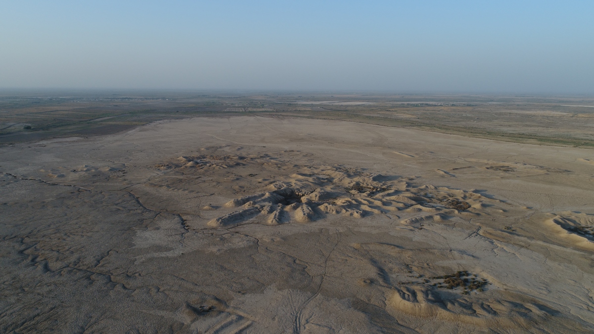
Aerial view of Tell A and the Sacred City of Girsu (Tello-Girsu Project, Iraq Scheme, The British Museum)

Excavations in the autumn of 2016 and spring of 2017 at Tello were carried out in the heart of the sacred district of Girsu, at Tell A, also-known as the Mound of the Palace. They led to the discovery of extensive mudbrick walls – some ornamented with pilasters and inscribed cones – belonging to the Ningirsu temple constructed and several times renovated by Sumerian rulers, including Ur-Bau and Gudea. This temple called Eninnu: The-White-Thunderbird dedicated to the heroic god was considered in antiquity as one of the most important sacred places of Mesopotamia, praised for its splendour in many contemporary literary compositions. The search for the Eninnu has mesmerized generations of Assyriologists. Known until now only by cuneiform texts and a plan carved on a statue of a worshipping Gudea, its discovery represents a significant milestone in the history of renewed archaeological research in Iraq.

Of this four-thousand-year-old religious complex, were exposed during the first two seasons what appeared to be the central part of the sanctuary: a decorated entrance featuring buttresses, a peripheral ambulatory with in situ cones, the cella composed of an offering altar facing the podium for the divine cult statue, and passageways marked by colossal inscribed stones.

Tello British Museum
Drone training at the temple site (Tello-Girsu Project, Iraq Scheme, The British Museum)

The results of the last autumn 2017 season were extremely successful. In the Mound of the Palace, we continued to excavate the monumental sacred complex belonging to the god Ningirsu. The main highlights were the discovery of the South gate flanked by two towers and the temenos wall which included a foundation box.

The box was unusually big, 9 courses high, with a large Gudea brick as the cover with the inscription face down. Under the cover, a well-preserved impression of a reed mat in bitumen. The box unfortunately had been opened in antiquity and the copper foundation figurine removed. But, at the bottom of the box, we found the stone tablet still in situ. A white square tablet with the inscription in two columns. The tablet was oriented towards the cella and the podium for the divine cult statue. It was buried in a deposit of pure sand and was placed on a small reed mat. Samples of bitumen and soils from the ritual box have been brought back to the British Museum to be analysed.

Excavating inscribed cones from the walls of the temple (Tello-Girsu Project, Iraq Scheme, The British Museum)

More than fifteen inscribed cones were found in situ in the walls of the temple. The recording of the exact location of each cone reveals that they were laid in a complex pattern; we are currently analysing this pattern to establish whether it encodes information of magical/religious significance.

Excavations under the temple also led to the discovery of two superimposed monumental platforms, the oldest of which, made of red mudbricks and built in two steps, may be dated to the beginning of the third millennium BC. This is an important discovery since this proto-ziggurat, a precursor to the legendary Tower of Babel, would therefore predate the earliest-known Mesopotamian stepped-terrace by a few hundred years.

Four new soundings were opened in Tell L, situated at the edge of the ancient city in the vicinity of the city wall. They also yielded important results. We have uncovered mudbrick walls, and another foundation box made of fired bricks, unfortunately empty. We have reasons to believe, however, on the basis of inscribed cones in secondary context and others scattered on the surface, that this mound (Tell L) and the one adjacent to it (Tell M) formed a large complex, perhaps a temple gate dedicated to the goddesses Inanna and Nanshe. This new excavation was closely connected to the extensive survey that was carried out in the western residential area, between the Sacred city and Tell L, which yielded important new information on the domestic quarters of the city of Girsu.

Aerial view of the bridge and the city of Girsu in the background (Tello-Girsu Project, Iraq Scheme, The British Museum)

New conservation work was initiated on the Bridge of Girsu, discovered and excavated at the end of the 1920s and early 1930s. The preliminary condition assessment of this unique monument of Sumerian architecture, left exposed for 80 years, stressed the urgency of carrying out a larger and more ambitious conservation programme, including preventive excavations.

Since excavation, the site has remained open and exposed, with no identifiable conservation work to address long-term stability or issues of erosion, and no plans to manage the site, or engage with a local or wider audiences.

The objectives of the 2017 autumn season at the bridge site were therefore to understand the structure, record its condition and to test conservation options, as the first steps towards developing a comprehensive conservation plan, with the Iraqi archaeologists involved at every stage.

Tello British Museum
Conservation training at the bridge site (Tello-Girsu Project, Iraq Scheme, The British Museum)

Excavations to establish the condition and stability of this construction led to the discovery of exceptionally well-preserved deposits of the prehistoric Ubaid period, including painted pottery and uninscribed cones, which yield a wealth of information on the origins of Girsu and consequently the birth of urban centres in Mesopotamia.

All the important finds from these excavations have already been safely delivered to the Iraq Museum in Baghdad, while a column base from the Ningirsu temple will be displayed in the nearby museum of Nasiriya.

Tello British Museum
Tello-Girsu Autumn 2017 team (Tello-Girsu Project, Iraq Scheme, The British Museum)

Tello-Girsu Autumn 2017 team & Iraqi participants: Sebastien Rey, Fatma Husain, Jon Taylor, Ashley Pooley, Angelo Di Michele, Joanna Skwiercz, Faith Vardy, Elisa Girotto, Ella Egberts, Dita Auzina, Dani Tagen, Andrew Ginns, Luke Jarvis, Thea Rogerson, John Darlington, Zahid Mohammad Oleiwi, Ali Kamil Khazaal, Toufeek Abd Mohammad, Qasim Rashid.

With Special Thanks to Vice Minister Dr Qais Hussein Rasheed, State Board of Antiquities and Heritage, Iraq

Contacts and website

Iraq Emergency Heritage Management Training Scheme

For more information on the Iraq Scheme, contact the Director of the Scheme, Jonathan Tubb (Head of the Middle East Department of the British Museum). Email: jtubb@britishmusuem.org

Tello-Ancient Girsu Project

For more information on the work at Tello, contact Sebastien Rey (Director of the Tello-Ancient Girsu Project). Email srey@britishmusuem.org

Iraq Scheme website

http://www.britishmuseum.org/about_us/museum_activity/middle_east/iraq_scheme.aspx

Featured image: Aerial view of the main complex of archaeological mounds of Tello (Tello-Girsu Project, Iraq Scheme, The British Museum)

9781784913892Sincerest thanks to Sebastien Rey for providing this blog post. Sebastien’s book For the Gods of Girsu: City-State Formation in Ancient Sumer (2016) is available now in paperback and eBook formats. English and Arabic editions available.